Area Overview for Stanway
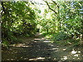
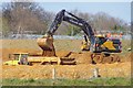
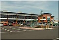
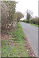
Photos of Stanway

Area Information
Stanway is a civil parish covering an area of 11.4 square kilometres with a total population of 2,557 residents. The community is characterised by its location approximately three miles west of Colchester city centre, situated near the junction of the A12 and A1124 at Eight Ash Green. You are living in a suburb that has transitioned from historical village roots to a modern western extension of the Colchester built-up area. The historic links to the Roman road, previously known as the stone way, define its position within the wider county. While the land contains Iron Age enclosures and burials dating back to the first century AD, current daily life revolves around proximity to urban amenities. Locals benefit from easy access to major transport arteries without being buried in the urban sprawl of the city. You will find Stanway School on the doorstep and Colchester Zoo nearby, an award-winning attraction that draws visitors from across the United Kingdom. The parish sits comfortably within the Colchester district of Essex, blending suburban convenience with a distinct identity. Residents here enjoy a leafy environment where the legacy of the late Iron Age meets contemporary residential needs. This makes Stanway a practical choice for those seeking a formal connection to the city while maintaining a separate parish boundary and local governance structure.
- Area Type
- District Borough Unitary Ward
- Area Size
- 11.4 km²
- Population
- 2557
- Population Density
- 1205 people/km²
Demographics
The community in Stanway reflects a quiet, established neighbourhood with a significant proportion of older residents. The median age across the parish is 70 years, indicating that you will be among significantly older neighbours in Stanway. This demographic profile suggests a population that has remained in the area for extended periods, contributing to a stable social fabric. There is no specific data on the most common age range beyond the median figure, but the high median age clearly shapes the local needs and rhythm of life. Home ownership stands at 78 percent within the parish. This high rate indicates that most residents owning their homes in Stanway rather than renting. The data does not provide a breakdown by ethnicity or specific religious affiliations, but the overall picture points to a settled community. You will find that the vast majority of the 2,557 people living here own the property they inhabit. This level of tenure stability often correlates with lower turnover and a neighbourliness that develops over decades. You are looking at a demographic that values local roots. The total household composition and accommodation type data are available but not specified in detail, yet the ownership figure provides a strong anchors for understanding the social structure of this civil parish.
Household Size
Accommodation Type
Tenure
Ethnic Group
Religion
Household Composition
Age
Household Deprivation
NS-SEC
Explore more demographic insights in this area
Go to Demographics tabPlanning
Planning Constraints
- Flood RiskPremium
- Ramsar Wetland SitesPremium
- Area of Outstanding Natural BeautyPremium
- Protected Nature ReservePremium
- Protected WoodlandPremium