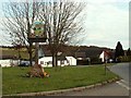
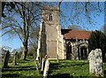
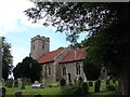
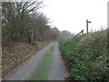
Area Overview for Stanstead
Photos of Stanstead
Area Information
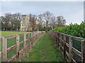
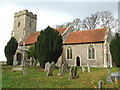
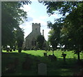
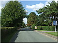
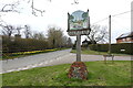
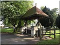
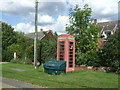
Living in Stanstead means residing in a civil parish defined by its rural character and established traditions. This sprawling area covers 4.8 square kilometres, offering a significant amount of open space compared to densely built urban districts. The location is situated within Greater London, yet it maintains a distinct identity separate from the immediate city centre. Daily life here revolves around a quieter pace, away from the congestion of major thoroughfares. You will find yourself surrounded by the natural features that define the parish boundary, including stretches of protected woodland. This environment provides a sense of separation from the bustle of metropolitan living. The community is built upon long-term settlement patterns, evidenced by the high rate of property ownership. Fewer than one in ten residents rent their homes, indicating a neighbourhood where people have settled with intention. The demographic weight leans heavily towards older generations, creating a community that values stability over constant turnover. When you choose Stanstead, you select an environment where the physical landscape is consistent with a low-rise, mature setting. The area avoids the planning constraints associated with Ramsar wetland sites or Areas of Outstanding Natural Beauty, yet it retains enough greenery to prevent over-development from dominating the visual horizon.
- Area Type
- Parish
- Area Size
- 4.8 km²
- Population
- Not available
- Population Density
- Not available
Demographics
The population profile of Stanstead presents a clear picture of an area dominated by older residents. The median age reaches exactly 70 years, confirming that the majority of households are composed of mature individuals or retirees. This age distribution shapes the social rhythm of the village, with community activities and local services likely catering to those with pensioner needs. Unlike areas with a young working population or families raising children, Stanstead focuses on later-life living. Home ownership stands as the definitive trait of this community, with 82% of residents owning their properties outright or through a mortgage. This figure leaves only 18% of households as tenants, creating a stable environment where people have a long-term stake in their location. The remaining minority of rental properties are likely smaller in number and distributed sporadically throughout the parish. There are no significant data points regarding deprivation levels or specific ethnic religious majorities in the provided records, meaning the focus remains entirely on these structural demographics. The household composition reflects a society where multi-generational families or couples in retirement form the core, without data suggesting a presence of young professionals or students. This concentration of older, owner-occupied residents creates a quiet, settled atmosphere that is consistent throughout the parish.
Household Size
Accommodation Type
Tenure
Ethnic Group
Religion
Household Composition
Age
Household Deprivation
NS-SEC
Explore more demographic insights in this area
Go to Demographics tabPlanning
Planning Constraints
- Flood RiskPremium
- Ramsar Wetland SitesPremium
- Area of Outstanding Natural BeautyPremium
- Protected Nature ReservePremium
- Protected WoodlandPremium
- Crime RiskPremium