Area Overview for Stanground South Ward
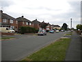
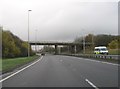
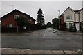
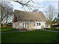
Photos of Stanground South Ward
Area Information
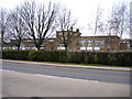
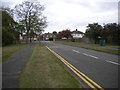
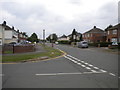
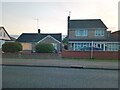
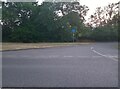
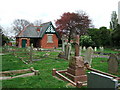
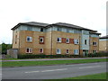
Living in Stanground South Ward offers a settled residential experience within the wider suburb of Stanground. This district ward sits within the City of Peterborough unitary authority in Cambridgeshire, covering an area of exactly 4.5 square kilometres. It lies south of the River Nene on relatively high ground that overlooks The Fens. The location has historical depth, having formed part of the Isle of Ely with its administrative boundaries shifting from spanning two counties in 1901 to being incorporated into the current Peterborough district in 1974. Today, the ward functions as a distinct part of the North West Cambridgeshire parliamentary constituency alongside neighbouring wards. The area seats a mature community characterised by established housing, schools, a fire station, and a cemetery. Prospective residents are moving into a grid-like environment that feels like a New Town district but retains a sense of being ringed by industry. The Church of St John the Baptist stands as a key landmark, housing the 12th-century Lampass Cross scheduled monument within its grounds. For those considering homes in this area, you are looking at a place defined by stability rather than rapid change, situated just west of the local junctions on Whittlesey Road.
- Area Type
- District Borough Unitary Ward
- Area Size
- 4.5 km²
- Population
- Not available
- Population Density
- Not available
Demographics
The community profile for Stanground South Ward is skewed significantly towards older residents. The median age stands at 70 years, making this the highest recorded median age for any ward in Peterborough. While the specific age group distribution is listed as total in the available records, the high median confirms a dominant population of seniors calling Stanground South Ward home. Housing tenure reflects this settled demographic, with a 61 per cent home ownership rate. This figure indicates that the majority of households own their properties outright or have a significant equity stake, suggesting long-term stability rather than a tenant-heavy environment. The ward accommodates a mix of private and social housing typical of a mature city suburb. Household composition data is recorded but not broken down into specific percentages in the provided set, though the age profile strongly implies many single-occupancy homes or families caring for older relatives. There are no specific constraints regarding protected characteristics such as ethnicity or religion in the source data, meaning the demographic narrative rests firmly on the age and tenure statistics. The 61 per cent ownership rate suggests an area where families have invested deeply in their local roots over many years.
Household Size
Accommodation Type
Tenure
Ethnic Group
Religion
Household Composition
Age
Household Deprivation
NS-SEC
Explore more demographic insights in this area
Go to Demographics tabPlanning
Planning Constraints
- Flood RiskPremium
- Ramsar Wetland SitesPremium
- Area of Outstanding Natural BeautyPremium
- Protected Nature ReservePremium
- Protected WoodlandPremium