Area Overview for Stambourne
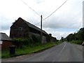
Photos of Stambourne
Area Information
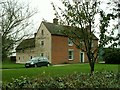
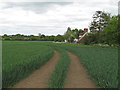
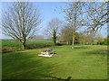
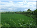
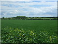
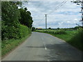
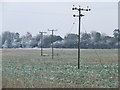
Stambourne is a civil parish located in the Braintree District of north Essex, covering a total area of 8.9 km². The village sits approximately eight miles north-west of Halstead and just over two miles from Yeldham railway station. Its name derives from Old English, meaning 'stony brook', and the settlement was first recorded in the Domesday Book as Stanburna in 1086. The site holds ancient Saxon roots, defined by historical landmarks that date back nearly a millennium. You will find the Grade I listed parish church of St Peter and St Thomas Becket stands centrally, dating from the 11th century. Nearby lies Stambourne Hall, a Grade II listed 15th-century building that overlooks the village green. Life in Stambourne centres around these historic monuments and the nearby playing field, which hosts an annual bonfire and fireworks display. The community operates with a strong sense of locality, anchored by its church and village hall. There is a distinct rural character to living here, with homes scattered across the parish boundaries. The post town is Halstead, which serves as the primary hub for regional connections and utilities. While the village maintains its historic identity, it functions as a quiet residential settlement rather than a commercial centre. Residents rely on the surrounding infrastructure for broader amenities. The location offers a direct link to Yeldham railway station for those requiring rail access. This historic setting provides a backdrop for daily life that few modern developments can replicate in the region.
- Area Type
- Parish
- Area Size
- 8.9 km²
- Population
- Not available
- Population Density
- Not available
Demographics
The community in Stambourne reflects a settled population with a median age of 70 years. This figure indicates a demographic skewed significantly towards older residents who have long-term ties to the parish. The most common age grouping aligns with this median, suggesting a mature household structure is dominant. Home ownership stands at 78% within the parish, a metric that defines the economic stability of the area. Three quarters of residents own their homes outright or with a mortgage, contrasting sharply with rental markets found in larger urban centres. Data on household composition, accommodation types, predominant ethnicity, and religious affiliation is not specified in the current records, but the ownership rate strongly implies a traditional, family-oriented or retired demographic. High ownership levels typically correlate with lower demographic churn, meaning the local population remains relatively consistent over time. This stability supports a quiet environment where generations often reside in the same properties. The absence of significant rental activity suggests fewer transient residents and a more cohesive social fabric. When considering living in Stambourne, you should expect a neighbourly atmosphere where the same families have lived for decades. The 78% ownership rate is particularly notable for a parish of its size. This statistic means the local economy relies heavily on the value and maintenance of private房产 rather than student housing or short-term lets.
Household Size
Accommodation Type
Tenure
Ethnic Group
Religion
Household Composition
Age
Household Deprivation
NS-SEC
Explore more demographic insights in this area
Go to Demographics tabPlanning
Planning Constraints
- Flood RiskPremium
- Ramsar Wetland SitesPremium
- Area of Outstanding Natural BeautyPremium
- Protected Nature ReservePremium
- Protected WoodlandPremium
- Crime RiskPremium