Area Overview for Stagsden
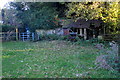
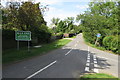
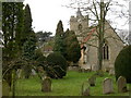
Photos of Stagsden


Area Information
Stagsden is a small built-up area in England, covering 22.4 hectares. It is a compact, well-defined community with a distinct character shaped by its older demographic profile. The area is home to a population with a median age of 70, suggesting a community skewed toward retirees and long-term residents. This age profile influences the local rhythm of life, with a focus on stability and established routines. Stagsden’s proximity to Bedford and its surrounding amenities makes it a practical choice for those seeking a quieter, less densely populated environment. The area’s size means it is walkable, with essential services and transport links within easy reach. While not a sprawling suburb, Stagsden offers a sense of cohesion, with its retail, rail, and transport networks providing access to nearby towns and attractions. For those prioritising safety, low crime risk and a strong sense of community are notable features. Living here means balancing the benefits of a settled, mature population with the practicality of nearby infrastructure, making it appealing to those seeking a stable, low-maintenance lifestyle.
- Area Type
- Built Up Area 250
- Area Size
- 22.4 hectares
- Population
- Not available
- Population Density
- Not available
Residents of Stagsden have access to a range of nearby amenities that support daily life. The area is within walking or short driving distance of five retail outlets, including The Southern Co-operative Co, Sainsburys Bedford, and Lidl Ridge, providing convenience for grocery shopping and general retail needs. Three railway stations—Bedford, Kempston Hardwick, and Bedford St Johns—offer regular commuter services to larger towns and cities, making it easier to access employment or social opportunities beyond Stagsden. Cranfield Airport, though not a major hub, adds to the area’s connectivity. While the data does not mention parks or leisure facilities, the presence of multiple retail and transport options suggests a lifestyle focused on practicality and accessibility. The mix of local shops and transport links ensures residents can meet their needs without long commutes, contributing to a self-contained, community-oriented environment.
Amenities
Schools
| Rank | School | Type | Entry gender | Ages |
|---|
Explore more schools in this area
Go to Schools tabDemographics
The population of Stagsden has a median age of 70, reflecting a community dominated by older residents. This age profile suggests a demographic with established routines and a focus on long-term stability. Home ownership is high, with 87% of households owning their homes, indicating a largely settled population with little turnover. The data does not specify household composition or accommodation types, but the high ownership rate implies a community where property is often passed down or held for extended periods. The absence of detailed figures on diversity or religious composition means the area’s cultural and social makeup remains less defined in the data. However, the overall picture is one of a mature, owner-occupied population with a strong emphasis on continuity. This profile may appeal to retirees or those seeking a quiet, low-traffic environment, though it also means the community’s character is less influenced by younger families or transient populations.
Household Size
Accommodation Type
Tenure
Ethnic Group
Religion
Household Composition
Age
Household Deprivation
NS-SEC
Explore more demographic insights in this area
Go to Demographics tabPlanning
Planning Constraints
- Crime RiskPremium