Area Overview for St Olaves
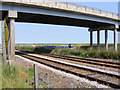
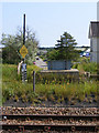
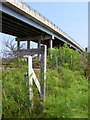
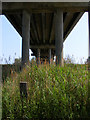
Photos of St Olaves

Area Information
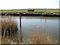
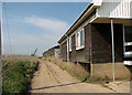
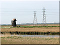
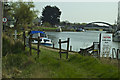
St Olaves is a compact built-up area in England, spanning 39.4 hectares. Its character is shaped by a population with a median age of 70, suggesting a community leaning towards older residents. The area’s proximity to multiple rail stations, including Haddiscoe Railway Station, and retail hubs like Tesco Belton and Sainsburys Bradwell, ensures practical access to daily essentials. A ferry service at Reedham Ferry North adds a unique dimension to local connectivity. Life here balances routine with accessibility, with homes predominantly owner-occupied at 83%. The low crime risk score of 85 indicates a safe environment, though broadband quality remains a consideration for those reliant on high-speed internet. St Olaves offers a quiet, established living experience, ideal for those prioritising security and convenience over urban vibrancy.
- Area Type
- Built Up Area 250
- Area Size
- 39.4 hectares
- Population
- Not available
- Population Density
- Not available
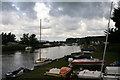
Residents of St Olaves have access to a range of nearby amenities within practical reach. Five rail stations, including Haddiscoe Railway Station, provide regular commuting options, while retail outlets such as Tesco Belton, Sainsburys Bradwell, and Asda Hopton-on cater to daily shopping needs. The Reedham Ferry North offers a unique connection to water-based travel, adding a distinct character to the area. Though specific dining or leisure venues are not listed, the presence of multiple retail stores suggests a functional commercial environment. The combination of rail, retail, and ferry access ensures a lifestyle that balances convenience with the quietude of a smaller community.
Amenities
Schools
| Rank | School | Type | Entry gender | Ages |
|---|
Explore more schools in this area
Go to Schools tabDemographics
The population of St Olaves has a median age of 70, with the most common age range encompassing all demographics. Home ownership is high at 83%, reflecting a community where most residents live in their own homes. The data does not specify household composition or accommodation types, but the overall profile suggests a stable, mature population. While no detailed breakdown of ethnic groups or religions is provided, the area’s safety and infrastructure cater to a diverse range of needs. The absence of specific deprivation data means quality of life assessments remain generalised, but the low crime risk and access to amenities suggest a functional, if unremarkable, living environment.
Household Size
Accommodation Type
Tenure
Ethnic Group
Religion
Household Composition
Age
Household Deprivation
NS-SEC
Explore more demographic insights in this area
Go to Demographics tabPlanning
Planning Constraints
- Crime RiskPremium