Area Overview for St Neots
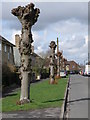
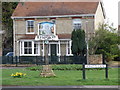
Photos of St Neots


Area Information
St Neots is a small built-up area in England, covering 8.1 km² with a population of 1204 residents. Its population density of 148 people per square kilometre suggests a compact, low-rise character, typical of smaller towns. The area’s proximity to St Neots Railway Station offers practical transport links, while nearby shops like Iceland, Waitrose, and Morrisons provide everyday convenience. With a median age of 70, the community is predominantly older, which may reflect a quieter, more established atmosphere. This demographic profile, combined with the area’s modest size, creates a distinct local identity where daily life is likely shaped by familiar routines and a close-knit environment. For homebuyers, St Neots offers a blend of practicality and tranquillity, with schools and amenities within easy reach. While the population is small, the area’s infrastructure supports a functional lifestyle, making it appealing to those seeking a manageable, community-focused setting.
- Area Type
- Built Up Area 250
- Area Size
- 8.1 km²
- Population
- 1204
- Population Density
- 148 people/km²
St Neots offers a range of amenities within practical reach, including retail options such as Iceland, Waitrose, and Morrisons, which provide grocery and household essentials. The St Neots Railway Station adds to the area’s accessibility, allowing residents to travel to larger towns for additional services. While the data does not specify parks or leisure facilities, the presence of multiple schools and shops suggests a focus on community needs. The compact size of the area ensures that amenities are not far from homes, contributing to a convenient lifestyle. For residents, the balance of retail, transport, and education makes St Neots a functional choice, though those seeking expansive leisure options may need to look further afield.
Amenities
Schools
St Neots is served by several primary schools, including Priory Park Infant School & Pre-School, Bushmead Junior School, Priory Junior School, Middlefield Community Primary School, and Bushmead Infant School. Of these, Priory Park Infant School and Priory Junior School both hold Ofsted ratings of “good,” indicating a solid standard of education. The presence of multiple primary schools within the area provides families with options, though the absence of secondary schools means students may need to commute to nearby towns. The mix of school types suggests a focus on early education, which is practical for younger families. However, the lack of detailed performance data for all schools means prospective buyers should investigate further to assess which institutions best meet their needs.
| Rank | School | Type | Entry gender | Ages |
|---|
Explore more schools in this area
Go to Schools tabDemographics
St Neots has a median age of 70, indicating a predominantly older population. The most common age range is listed as “Age: Total,” suggesting data aggregation rather than breakdowns by specific brackets. Home ownership here is robust, with 69% of residents owning their homes. This figure implies a stable, long-term community with fewer renters. The accommodation types and household composition data are not specified, but the high home ownership rate likely reflects a mix of family homes and retirement properties. The area’s demographic profile, with its older residents, may influence local services and amenities, aligning them with the needs of an established population. While no specific data on ethnic diversity or religious composition is provided, the absence of such details does not detract from the area’s practical appeal for those seeking a settled, low-maintenance environment.
Household Size
Accommodation Type
Tenure
Ethnic Group
Religion
Household Composition
Age
Household Deprivation
NS-SEC
Explore more demographic insights in this area
Go to Demographics tabPlanning
Planning Constraints
- Crime RiskPremium