Area Overview for St. Margaret, South Elmham
Photos of St. Margaret, South Elmham
Area Information
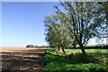
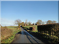
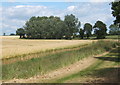
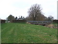
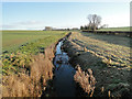
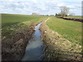
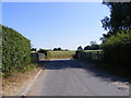
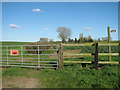
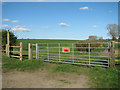
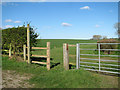
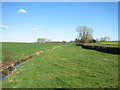
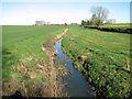
St. Margaret, South Elmham is a small civil parish located in Suffolk, covering an area of exactly 2.4 km². This settlement occupies a scattered village centred around coordinates 52.406169, 1.403243, situated along a minor road south of the Beck, which serves as a tributary of the River Waveney. The parish is defined by flat arable land and a few houses clustered directly around its historic church. There are no shops or pubs within the immediate parish boundaries, which frames daily life around travel to neighbouring towns. The location falls within the ancient South Elmhams deanery and remains part of the broader South Elmham community. Living in St. Margaret, South Elmham offers proximity to significant historical landmarks without being embedded in a larger urban centre. Residents have easy access to the Grade I listed Church of St Margaret and South Elmham Hall, a medieval moated bishop's palace located on the eastern parish edge. The area retains its pre-modern character, centred on a Norman south doorway, a 14th-century tower, and a 15th-century Perpendicular chancel. The church itself stands as a focal point, having been restored in the 1830s and the 1870s. For those seeking a quiet, rural existence anchored by ancient history, this parish provides a distinct setting close to the river system and open countryside.
- Area Type
- Parish
- Area Size
- 2.4 km²
- Population
- Not available
- Population Density
- Not available
Demographics
The community in St. Margaret, South Elmham is characterised by a significantly older median age of 70 years. This demographic profile indicates that the area is populated predominantly by retirees rather than families with young children or young professionals. While specific data on household composition and household count is not explicitly detailed as separate figures, the total household composition data supports this notion of an older population structure. The predominance of older residents suggests a quiet environment with little daytime activity during working hours. Home ownership stands at 75% within the parish, indicating that the majority of residents own their properties outright or with a mortgage. This high rate of ownership is typical for rural parishes in England where estates have been held across generations. The data shows that Accommodation Type is recorded as total, reflecting a mix of housing stock rather than a single modern development. Religious affiliation is tracked as total, suggesting traditional community structures remain in place despite the low population density. The area holds an Elizabethan chalice from 1567, and the church registers date back to 1679, mirroring the long-term settlement patterns of the inhabitants.
Household Size
Accommodation Type
Tenure
Ethnic Group
Religion
Household Composition
Age
Household Deprivation
NS-SEC
Explore more demographic insights in this area
Go to Demographics tabPlanning
Planning Constraints
- Flood RiskPremium
- Ramsar Wetland SitesPremium
- Area of Outstanding Natural BeautyPremium
- Protected Nature ReservePremium