Area Overview for St. Margaret, Ilketshall
Photos of St. Margaret, Ilketshall
Area Information
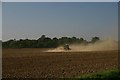
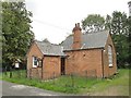
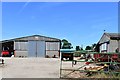
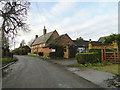
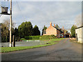
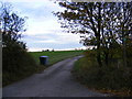
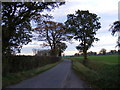
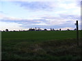
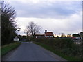
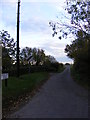
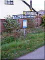
St. Margaret, Ilketshall is a civil parish covering an area of 8.5 km² in England. Living here means residing in a location defined by its size and specific rural character. The parish functions as a distinct community unit separate from the broader village of Ilketshall St Margaret, though the two names often overlap in local usage. You are entering an environment where space is defined by the square kilometres of land you occupy. The area does not boast major urban centres within its 8.5 km² boundary. Instead, daily life revolves around the specific geography of this civil parish. This setting attracts those who prioritise land and seclusion over metropolitan convenience. You find yourself in a parish where the layout reflects traditional English countryside planning. The name St. Margaret, Ilketshall carries historical weight while describing a modern living environment. Prospective buyers should understand the scale before viewing homes. The 8.5 km² footprint dictates travel distances and the availability of immediate amenities. You are purchasing a piece of a defined geographical unit rather than a generic postcode. The parish boundaries matter when considering commute routes or local access. This area represents a specific commitment to a smaller-scale existence. The civil parish structure provides a clear legal and administrative identity for your future home.
- Area Type
- Parish
- Area Size
- 8.5 km²
- Population
- Not available
- Population Density
- Not available
Demographics
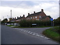
The community in St. Margaret, Ilketshall reflects a significant shift towards retirement and later life. The median age stands at exactly 70 years, confirming that the population skews heavily older than the national average. Most residents fall into the broader 'Total' age category, meaning specific younger cohorts are less common. You are likely to encounter neighbours who have lived in homes here for decades or moved from busy urban centres seeking a quieter pace. Home ownership is exceptionally high, with 75% of dwellings owned outright or with a mortgage. This figure indicates that renting is a rare experience for the majority of locals. The area is characterised by a settled population rather than transient students or young professionals. Household composition data suggests standard traditional family or single-person setups typical for this age group. There is no significant youth bulge to offset the ageing trend. You will have a neighbourhood where garden maintenance, local clubs, and quiet streets are the norm. The 75% ownership rate creates a stable community where people have a vested long-term interest in their street. This stability permeates the daily atmosphere of the parish. Statistics confirm that this is an area defined by maturity and established tenure.
Household Size
Accommodation Type
Tenure
Ethnic Group
Religion
Household Composition
Age
Household Deprivation
NS-SEC
Explore more demographic insights in this area
Go to Demographics tabPlanning
Planning Constraints
- Flood RiskPremium
- Ramsar Wetland SitesPremium
- Area of Outstanding Natural BeautyPremium
- Protected Nature ReservePremium
- Protected WoodlandPremium
- Crime RiskPremium