Area Overview for St. Luke's Ward
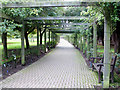
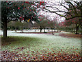
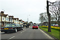
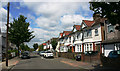
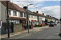
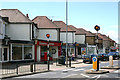
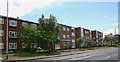
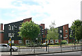
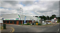
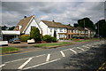
Photos of St. Luke's Ward


Area Information
St. Luke's Ward occupies a compact footprint within Southwark, covering an area of just 3.5 square kilometres. Living in this district offers a sense of intimate neighbourhood life due to its limited physical size. The median age of residents is 70 years, indicating that this is a retirement-focused community. Daily life here revolves around a demographic where the majority of the population has reached retirement age. You will find a quiet environment compared to younger, family-heavy districts, with a community built around the needs of older professionals and retirees. The ward represents a specific slice of London where housing stock and amenities cater to a mature demographic. While the area lacks the dynamic energy of university quarters, it provides a settled atmosphere suitable for those seeking a change of pace. The small geographical size means that travel between local points of interest is short, fostering a connected community feel without the congestion of larger boroughs. Prospective buyers looking for a retirement haven within easy reach of central London times find this ward offers a focused residential experience.
- Area Type
- District Borough Unitary Ward
- Area Size
- 3.5 km²
- Population
- Not available
- Population Density
- Not available
Demographics
The community in St. Luke's Ward is defined by a very specific age profile, with a median age of 70 years. This statistic confirms that the ward is primarily inhabited by older adults. Household composition reflects this, showing a population skewed towards single-person households or couples where one or both partners are retired. Homeownership stands at 64 per cent. This high rate of ownership suggests that many residents have built significant equity over time or purchased to downsize into more manageable homes. Accommodation types generally align with these needs, though specific breakdowns by property classification are not detailed beyond the total figures provided. The demographic data paints a clear picture of stability. Residents here are likely to be looking for low-maintenance living. Deprivation levels are not explicitly quantified in the available data, but the high ownership rate often correlates with resident investment in the area. Education levels among the population typically reflect the cohort, with a concentration of retired professionals and those who worked in established roles across Southwark. The community feels established rather than transient.
Household Size
Accommodation Type
Tenure
Ethnic Group
Religion
Household Composition
Age
Household Deprivation
NS-SEC
Explore more demographic insights in this area
Go to Demographics tabPlanning
Planning Constraints
- Flood RiskPremium
- Ramsar Wetland SitesPremium
- Area of Outstanding Natural BeautyPremium
- Protected Nature ReservePremium
- Protected WoodlandPremium
- Crime RiskPremium