Area Overview for St. Ives West Ward
Photos of St. Ives West Ward


Area Information
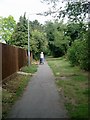
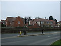
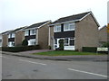
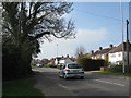
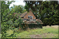
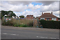
Living in St. Ives West Ward offers a specific experience within the historic market town of St Ives in Cambridgeshire. This district ward sits at the heart of the medieval settlement, located on the River Great Ouse between Huntingdon and Ely. It covers 1.2 square kilometres and forms part of a division represented by a single councillor on Huntingdonshire District Council. The area's identity is deeply rooted in its history, originating in Anglo-Saxon times at a fording point before developing into a crucial stop for livestock drovers. You will find yourself walking past St Ives Bridge, a narrow stone structure from 1426 that once carried the main London Road. This bridge still passes through a chapel and leads to areas like Holt Island, where residents enjoy a nature reserve with boardwalks. Although the historic crossing was narrow, modern residents benefit from the 1980 by-pass that now handles through traffic. Daily life here combines the quiet of a riverside location with the commercial heritage of a town that served as a major cattle market. The ward contains All Saints Church, which includes parts dating back to the 12th century, adding to the sense of historical continuity in your neighbourhood.
- Area Type
- District Borough Unitary Ward
- Area Size
- 1.2 km²
- Population
- Not available
- Population Density
- Not available
Demographics
Household Size
Accommodation Type
Tenure
Ethnic Group
Religion
Household Composition
Age
Household Deprivation
NS-SEC
Explore more demographic insights in this area
Go to Demographics tabPlanning
Planning Constraints
- Flood RiskPremium
- Ramsar Wetland SitesPremium
- Area of Outstanding Natural BeautyPremium
- Protected Nature ReservePremium
- Protected WoodlandPremium