Area Overview for St. Anne's & St. John's Ward
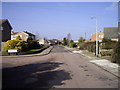
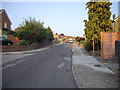
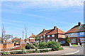
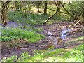
Photos of St. Anne's & St. John's Ward


Area Information
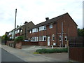
St. Anne's & St. John's Ward is a compact district within Colchester Borough Council, covering an area of 3.6 km². You will find approximately 1,345 residents living here, creating a population density of 374 people per square kilometre. This ward sits at the heart of Colchester, the UK's oldest recorded town, centred around the historic area of St. John's Abbey in the city centre. The postcode area includes CO4 0YL, placing you directly within a location rich in medieval heritage. The territory encompasses the site of a Saxon church where the Benedictine monastery was later founded by Eudo Dapifer from 1096 to 1115. Modern life here involves proximity to significant historical landmarks, most notably the St. John's Abbey Gatehouse, a fortified structure built around 1400. This monument remains a key remnant of the abbey, serving as a principal surviving feature of the ward. The area has a long and eventful history, dating back to 1095 when construction began using Roman rubble. You are walking distance from the site where Margaret Cavendish, a celebrated writer and natural philosopher, was born in 1623. Daily life involves navigating a neighbourhood defined by its deep roots in the past rather than recent urban development. The ward operates as a district borough unitary ward, integrating seamlessly into the broader administration of Colchester while maintaining its unique identity as the site of the dissolved abbey in 1539.
- Area Type
- District Borough Unitary Ward
- Area Size
- 3.6 km²
- Population
- 1345
- Population Density
- 374 people/km²
Demographics
The community in St. Anne's & St. John's Ward presents a clear demographic profile distinct from many other parts of Essex. The median age for residents is 70 years old, indicating a population heavily weighted towards older adults. This age structure defines the social fabric of the ward, suggesting a community where daily life revolves around the needs and interests of the elderly. Data from the most common age range confirms that this demographic skew is widespread. Households here are predominantly owned rather than rented, with a home ownership rate standing at 74%. This high percentage of ownership suggests significant long-term settlement within the boundaries of the ward. While the data provided does not specify the breakdown of household composition or predominant ethnic groups, the clear trends point to a stable, established population. The lack of rental properties aligns with the high ownership figures, creating a neighbourhood where residents are likely settled for decades. This stability contrasts with newer housing estates where turnover might be higher. You can expect the local services to cater primarily to the elder demographic, from healthcare access to community programs. The density of 374 people per square kilometre means the area is neither sprawling nor densely packed, offering a manageable scale for community engagement. Understanding this age distribution is essential for anyone considering moving to St. Anne's & St. John's Ward, as the local landscape is built around supporting an older population.
Household Size
Accommodation Type
Tenure
Ethnic Group
Religion
Household Composition
Age
Household Deprivation
NS-SEC
Explore more demographic insights in this area
Go to Demographics tabPlanning
Planning Constraints
- Flood RiskPremium
- Ramsar Wetland SitesPremium
- Area of Outstanding Natural BeautyPremium
- Protected Nature ReservePremium
- Protected WoodlandPremium