Area Overview for St Albans
Photos of St Albans


Area Information
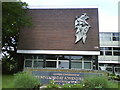
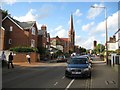
St Albans is a built-up area in England covering 17.4 km², home to 29,157 residents. With a population density of 1,673 people per square kilometre, it balances urban convenience with a compact footprint. The area’s median age of 70 suggests a community leaning towards older residents, though the data does not specify age distribution beyond this figure. Daily life here is shaped by proximity to amenities, with five retail outlets including Tesco and Sainsburys, and five railway stations offering connections to nearby towns. The presence of five primary schools, such as Bernards Heath Infant and Nursery School and Fleetville Junior School, underscores a focus on education. Broadband quality is excellent, with a score of 96, supporting remote work and digital needs. While the crime risk is rated as low, with a safety score of 71, the area’s appeal lies in its accessibility, infrastructure, and established residential character. For those seeking a town with practical amenities and a moderate population size, St Albans offers a straightforward, functional lifestyle.
- Area Type
- District/Borough
- Area Size
- 17.4 km²
- Population
- 29157
- Population Density
- 1673 people/km²
Demographics
The population of St Albans has a median age of 70, indicating a community skewed towards older residents. The most common age range is listed as "Total," which likely encompasses all age groups but does not break them down further. Home ownership stands at 67%, reflecting a majority of residents living in their own homes. The data does not specify household composition or accommodation types, so these aspects remain unquantified. Predominant ethnic groups and religious affiliations are also categorised as "Total," offering no granular insight into cultural or demographic diversity. The absence of deprivation data means no conclusions can be drawn about economic challenges or quality-of-life factors related to income. However, the high home ownership rate suggests a stable residential base, though the age profile may influence local services and community dynamics.
Household Size
Accommodation Type
Tenure
Ethnic Group
Religion
Household Composition
Age
Household Deprivation
NS-SEC
Explore more demographic insights in this area
Go to Demographics tabPlanning
Planning Constraints
- Crime RiskPremium