Area Overview for SS9 5SF
Photos of SS9 5SF
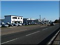
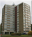
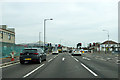
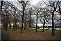
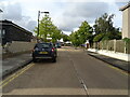
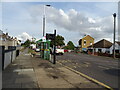
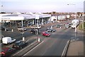
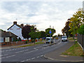
22 photos from this area
Area Information
Key information about the SS9 5SF including its size, population, and administrative classification.
- Area Type
- Postcode
- Area Size
- 1.5 hectares
- Population
- 1564
- Population Density
- 5155 people/km²
House Prices in SS9 5SF
37
Properties
£274,817
Average Sold Price
£74,000
Lowest Price
£450,000
Highest Price
Showing 37 properties
| Address | Type | Beds | Baths | Last Sale Price | Last Sale Date | |
|---|---|---|---|---|---|---|
| 54 Fairfield Gardens, Eastwood, SS9 5SF | house | - | - | £395,000 | Sep 2025 | |
| 76 Fairfield Gardens, Eastwood, SS9 5SF | Semi-detached | 3 | 1 | £375,000 | Nov 2023 | |
| 62 Fairfield Gardens, Eastwood, SS9 5SF | house | - | - | £390,000 | Jun 2022 | |
| 12 Fairfield Gardens, Eastwood, SS9 5SF | Bungalow | - | - | £327,000 | Feb 2022 | |
| 16 Fairfield Gardens, Eastwood, SS9 5SF | house | - | - | £350,000 | Feb 2022 | |
| 40 Fairfield Gardens, Eastwood, SS9 5SF | house | - | - | £440,000 | Jun 2021 | |
| 6 Fairfield Gardens, Eastwood, SS9 5SF | Bungalow | 3 | 1 | £357,000 | Mar 2021 | |
| 90 Fairfield Gardens, Eastwood, SS9 5SF | house | - | - | £300,000 | Sep 2019 | |
| 42 Fairfield Gardens, Eastwood, SS9 5SF | Bungalow | 3 | 1 | £306,000 | Apr 2019 | |
| 64 Fairfield Gardens, Eastwood, SS9 5SF | Semi-detached | 3 | 2 | £345,000 | Oct 2018 |
Page 1 of 4
Energy Efficiency in SS9 5SF
Amenities
Schools
| Rank | School | Type | Entry gender | Ages |
|---|
Explore more schools in this area
Go to Schools tabDemographics
Household Size
Two person
most common
Accommodation Type
Houses
most common
Tenure
91
majority
Ethnic Group
White
most common
Religion
N/A
most common
Household Composition
N/A
most common
Age
47
median
Adults (30-64 years)
most common
Household Deprivation
N/A
with no deprivation
NS-SEC
35
in Lower managerial occupations
Explore more demographic insights in this area
Go to Demographics tabPlanning
Planning Constraints
- Flood RiskPremium
- Ramsar Wetland SitesPremium
- Area of Outstanding Natural BeautyPremium
- Protected Nature ReservePremium
- Protected WoodlandPremium