Area Overview for SS9 5HU
Photos of SS9 5HU
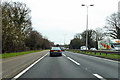
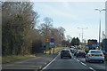
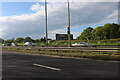
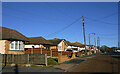
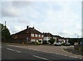
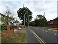
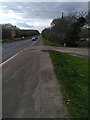
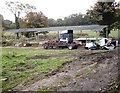
22 photos from this area
Area Information
Key information about the SS9 5HU including its size, population, and administrative classification.
- Area Type
- Postcode
- Area Size
- 1.4 hectares
- Population
- 1738
- Population Density
- 4184 people/km²
House Prices in SS9 5HU
46
Properties
£261,118
Average Sold Price
£137,000
Lowest Price
£493,000
Highest Price
Showing 46 properties
| Address | Type | Beds | Baths | Last Sale Price | Last Sale Date | |
|---|---|---|---|---|---|---|
| 582 Rayleigh Road, Eastwood, SS9 5HU | Maisonette | - | - | £175,000 | Mar 2025 | |
| 584 Rayleigh Road, Eastwood, SS9 5HU | Maisonette | - | - | £175,000 | Mar 2025 | |
| 622 Rayleigh Road, Eastwood, SS9 5HU | Bungalow | 3 | 1 | £330,000 | Jan 2023 | |
| 610 Rayleigh Road, Eastwood, SS9 5HU | Semi-detached | 3 | 2 | £330,000 | Jun 2021 | |
| 598 Rayleigh Road, Eastwood, SS9 5HU | house | - | - | £405,000 | May 2020 | |
| 614 Rayleigh Road, Eastwood, SS9 5HU | Bungalow | - | - | £315,000 | Jan 2020 | |
| 606 Rayleigh Road, Eastwood, SS9 5HU | Detached | 4 | - | £493,000 | Mar 2018 | |
| 620 Rayleigh Road, Eastwood, SS9 5HU | Semi-detached | 2 | 1 | £302,500 | Feb 2018 | |
| 604 Rayleigh Road, Eastwood, SS9 5HU | Semi-detached | 4 | - | £325,000 | Jul 2016 | |
| 608 Rayleigh Road, Eastwood, SS9 5HU | Detached | 1 | 3 | £365,000 | Jul 2015 |
Page 1 of 5
Energy Efficiency in SS9 5HU
Amenities
Schools
| Rank | School | Type | Entry gender | Ages |
|---|
Explore more schools in this area
Go to Schools tabDemographics
Household Size
Family (3-5 people)
most common
Accommodation Type
Houses
most common
Tenure
77
majority
Ethnic Group
White
most common
Religion
N/A
most common
Household Composition
N/A
most common
Age
47
median
Adults (30-64 years)
most common
Household Deprivation
N/A
with no deprivation
NS-SEC
31
in Lower managerial occupations
Explore more demographic insights in this area
Go to Demographics tabPlanning
Planning Constraints
- Flood RiskPremium
- Ramsar Wetland SitesPremium
- Area of Outstanding Natural BeautyPremium
- Protected Nature ReservePremium
- Protected WoodlandPremium