Area Overview for SS9 5BL
Photos of SS9 5BL
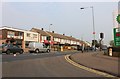
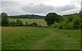
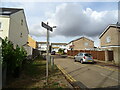
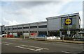
36 photos from this area
Area Information
Key information about the SS9 5BL including its size, population, and administrative classification.
- Area Type
- Postcode
- Area Size
- 1.2 hectares
- Population
- 1509
- Population Density
- 5093 people/km²
House Prices in SS9 5BL
32
Properties
£245,284
Average Sold Price
£50,000
Lowest Price
£391,000
Highest Price
Showing 32 properties
| Address | Type | Beds | Baths | Last Sale Price | Last Sale Date | |
|---|---|---|---|---|---|---|
| 17 Springwater Grove, Eastwood, Leigh On Sea, SS9 5BL | Bungalow | 2 | - | £391,000 | Jul 2025 | |
| 12 Springwater Grove, Eastwood, Leigh On Sea, SS9 5BL | Detached | 2 | 1 | £320,000 | Jun 2025 | |
| 34 Springwater Grove, Eastwood, Leigh On Sea, SS9 5BL | Semi-detached | 4 | 2 | £380,000 | Aug 2024 | |
| 28 Springwater Grove, Eastwood, Leigh On Sea, SS9 5BL | Semi-detached | 2 | 1 | £345,000 | Aug 2024 | |
| 21 Springwater Grove, Eastwood, Leigh On Sea, SS9 5BL | Bungalow | 2 | 1 | £338,000 | May 2024 | |
| 23 Springwater Grove, Eastwood, Leigh On Sea, SS9 5BL | Bungalow | 2 | - | £390,000 | Nov 2023 | |
| 35 Springwater Grove, Eastwood, Leigh On Sea, SS9 5BL | Bungalow | - | - | £350,000 | Jul 2022 | |
| 18 Springwater Grove, Eastwood, Leigh On Sea, SS9 5BL | Bungalow | - | - | £385,000 | Feb 2022 | |
| 38 Springwater Grove, Eastwood, Leigh On Sea, SS9 5BL | Semi-detached | 2 | - | £320,000 | Dec 2021 | |
| 19 Springwater Grove, Eastwood, Leigh On Sea, SS9 5BL | Bungalow | - | - | £305,000 | Jun 2021 |
Page 1 of 4
Energy Efficiency in SS9 5BL
Amenities
Schools
| Rank | School | Type | Entry gender | Ages |
|---|
Explore more schools in this area
Go to Schools tabDemographics
Household Size
Two person
most common
Accommodation Type
Houses
most common
Tenure
90
majority
Ethnic Group
White
most common
Religion
N/A
most common
Household Composition
N/A
most common
Age
47
median
Adults (30-64 years)
most common
Household Deprivation
N/A
with no deprivation
NS-SEC
33
in Lower managerial occupations
Explore more demographic insights in this area
Go to Demographics tabPlanning
Planning Constraints
- Flood RiskPremium
- Ramsar Wetland SitesPremium
- Area of Outstanding Natural BeautyPremium
- Protected Nature ReservePremium
- Protected WoodlandPremium