Area Overview for SS9 4HE
Photos of SS9 4HE
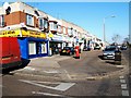
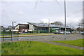
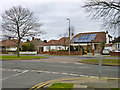
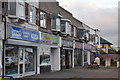
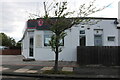
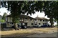
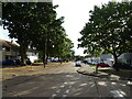
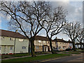

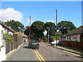
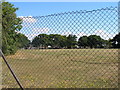
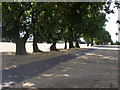
21 photos from this area
Area Information
Key information about the SS9 4HE including its size, population, and administrative classification.
- Area Type
- Postcode
- Area Size
- 9130 m²
- Population
- 1428
- Population Density
- 5096 people/km²
House Prices in SS9 4HE
24
Properties
£184,107
Average Sold Price
£55,000
Lowest Price
£330,000
Highest Price
Showing 24 properties
| Address | Type | Beds | Baths | Last Sale Price | Last Sale Date | |
|---|---|---|---|---|---|---|
| 57 Harridge Road, Leigh On Sea, SS9 4HE | Semi-detached | 2 | 1 | £325,000 | Feb 2025 | |
| 62 Harridge Road, Leigh On Sea, SS9 4HE | Semi-detached | 2 | 1 | £320,000 | Nov 2023 | |
| 54 Harridge Road, Leigh On Sea, SS9 4HE | house | - | - | £195,000 | Oct 2020 | |
| 70 Harridge Road, Leigh On Sea, SS9 4HE | Semi-detached | 2 | 1 | £290,000 | Sep 2018 | |
| 39 Harridge Road, Leigh On Sea, SS9 4HE | Semi-detached | 4 | 1 | £330,000 | Sep 2016 | |
| 68 Harridge Road, Leigh On Sea, SS9 4HE | house | 2 | - | £135,000 | Jun 2012 | |
| 59 Harridge Road, Leigh On Sea, SS9 4HE | house | - | - | £155,000 | Mar 2011 | |
| 61 Harridge Road, Leigh On Sea, SS9 4HE | house | - | - | £138,000 | Jan 2011 | |
| 53 Harridge Road, Leigh On Sea, SS9 4HE | house | 3 | - | £190,000 | Aug 2010 | |
| 65 Harridge Road, Leigh On Sea, SS9 4HE | Semi-detached | - | - | £150,000 | Feb 2006 |
Page 1 of 3
Energy Efficiency in SS9 4HE
Amenities
Schools
| Rank | School | Type | Entry gender | Ages |
|---|
Explore more schools in this area
Go to Schools tabDemographics
Household Size
Family (3-5 people)
most common
Accommodation Type
Houses
most common
Tenure
80
majority
Ethnic Group
White
most common
Religion
N/A
most common
Household Composition
N/A
most common
Age
47
median
Adults (30-64 years)
most common
Household Deprivation
N/A
with no deprivation
NS-SEC
33
in Lower managerial occupations
Explore more demographic insights in this area
Go to Demographics tabPlanning
Planning Constraints
- Flood RiskPremium
- Ramsar Wetland SitesPremium
- Area of Outstanding Natural BeautyPremium
- Protected Nature ReservePremium
- Protected WoodlandPremium