Area Overview for SS9 2NL
Photos of SS9 2NL

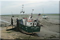
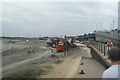
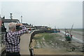
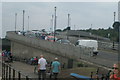
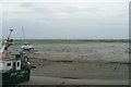
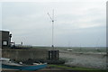
100 photos from this area
Area Information
Key information about the SS9 2NL including its size, population, and administrative classification.
- Area Type
- Postcode
- Area Size
- 14.9 hectares
- Population
- 1637
- Population Density
- 3999 people/km²
House Prices in SS9 2NL
20
Properties
£584,033
Average Sold Price
£125,000
Lowest Price
£1,325,000
Highest Price
Showing 20 properties
| Address | Type | Beds | Baths | Last Sale Price | Last Sale Date | |
|---|---|---|---|---|---|---|
| 88 Marine Parade, Leigh On Sea, SS9 2NL | Semi-detached | 4 | 2 | £1,100,000 | Mar 2022 | |
| 90 Marine Parade, Leigh On Sea, SS9 2NL | house | - | - | £680,000 | Mar 2021 | |
| 87 Marine Parade, Leigh On Sea, SS9 2NL | Semi-detached | 4 | 2 | £605,000 | Aug 2020 | |
| 77 Marine Parade, Leigh On Sea, SS9 2NL | Detached | 4 | 2 | £970,000 | Jul 2020 | |
| 80 Marine Parade, Leigh On Sea, SS9 2NL | Detached | 4 | 1 | £790,000 | May 2018 | |
| Lower Cliff House, Marine Parade, Leigh On Sea, SS9 2NL | house | - | - | £1,325,000 | Dec 2016 | |
| 93A Marine Parade, Leigh On Sea, SS9 2NL | Flat | 2 | - | £380,000 | Oct 2016 | |
| 86 Marine Parade, Leigh On Sea, SS9 2NL | house | - | - | £580,000 | Sep 2015 | |
| 92 Marine Parade, Leigh On Sea, SS9 2NL | house | - | - | £495,000 | Apr 2015 | |
| 89 Marine Parade, Leigh On Sea, SS9 2NL | Semi-detached | 3 | - | £520,000 | Aug 2013 |
Page 1 of 2
Energy Efficiency in SS9 2NL
Amenities
Schools
| Rank | School | Type | Entry gender | Ages |
|---|
Explore more schools in this area
Go to Schools tabDemographics
Household Size
Family (3-5 people)
most common
Accommodation Type
Houses
most common
Tenure
89
majority
Ethnic Group
White
most common
Religion
N/A
most common
Household Composition
N/A
most common
Age
47
median
Adults (30-64 years)
most common
Household Deprivation
N/A
with no deprivation
NS-SEC
53
in Lower managerial occupations
Explore more demographic insights in this area
Go to Demographics tabPlanning
Planning Constraints
- Flood RiskPremium
- Ramsar Wetland SitesPremium
- Area of Outstanding Natural BeautyPremium
- Protected Nature ReservePremium
- Protected WoodlandPremium