Area Overview for SS9 1QE
Photos of SS9 1QE
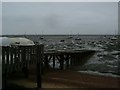
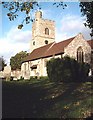
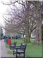
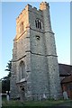
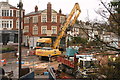
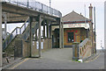
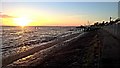
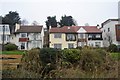
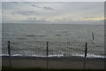
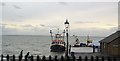
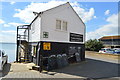
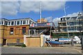
100 photos from this area
Area Information
Key information about the SS9 1QE including its size, population, and administrative classification.
- Area Type
- Postcode
- Area Size
- 9990 m²
- Population
- 1603
- Population Density
- 9944 people/km²
House Prices in SS9 1QE
34
Properties
£235,750
Average Sold Price
£67,000
Lowest Price
£432,000
Highest Price
Showing 34 properties
| Address | Type | Beds | Baths | Last Sale Price | Last Sale Date | |
|---|---|---|---|---|---|---|
| 21A North Street, Leigh On Sea, SS9 1QE | Flat | 1 | 1 | £240,000 | Feb 2025 | |
| 35A North Street, Leigh On Sea, SS9 1QE | Flat | 1 | 1 | £215,000 | Jan 2024 | |
| 36 North Street, Leigh On Sea, SS9 1QE | Semi-detached | 2 | 1 | £409,000 | Dec 2023 | |
| 9 North Street, Leigh On Sea, SS9 1QE | Terraced | 3 | 1 | £395,000 | May 2022 | |
| 40 North Street, Leigh On Sea, SS9 1QE | Terraced | 2 | 1 | £428,000 | Aug 2021 | |
| 37 North Street, Leigh On Sea, SS9 1QE | Semi-detached | 2 | 1 | £391,000 | Jul 2020 | |
| 33A North Street, Leigh On Sea, SS9 1QE | Flat | 2 | 1 | £225,000 | Nov 2018 | |
| 18 North Street, Leigh On Sea, SS9 1QE | Semi-detached | 3 | 1 | £432,000 | Jun 2016 | |
| 31 North Street, Leigh On Sea, SS9 1QE | house | - | - | £325,000 | Jan 2015 | |
| 43 North Street, Leigh On Sea, SS9 1QE | Detached | 1 | 1 | £174,995 | Jan 2014 |
Page 1 of 4
Energy Efficiency in SS9 1QE
Amenities
Schools
| Rank | School | Type | Entry gender | Ages |
|---|
Explore more schools in this area
Go to Schools tabDemographics
Household Size
One person
most common
Accommodation Type
Flats
most common
Tenure
58
majority
Ethnic Group
White
most common
Religion
N/A
most common
Household Composition
N/A
most common
Age
47
median
Adults (30-64 years)
most common
Household Deprivation
N/A
with no deprivation
NS-SEC
46
in Lower managerial occupations
Explore more demographic insights in this area
Go to Demographics tabPlanning
Planning Constraints
- Flood RiskPremium
- Ramsar Wetland SitesPremium
- Area of Outstanding Natural BeautyPremium
- Protected Nature ReservePremium
- Protected WoodlandPremium