Area Overview for SS9 1HW
Photos of SS9 1HW
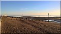
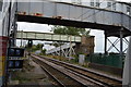
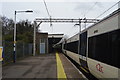
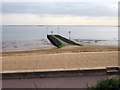
89 photos from this area
Area Information
Key information about the SS9 1HW including its size, population, and administrative classification.
- Area Type
- Postcode
- Area Size
- 9409 m²
- Population
- 1560
- Population Density
- 8754 people/km²
House Prices in SS9 1HW
46
Properties
£303,946
Average Sold Price
£4,000
Lowest Price
£837,500
Highest Price
Showing 46 properties
| Address | Type | Beds | Baths | Last Sale Price | Last Sale Date | |
|---|---|---|---|---|---|---|
| 64 Beach Avenue, Leigh On Sea, SS9 1HW | Semi-detached | 4 | 3 | £735,000 | Aug 2024 | |
| 47 Beach Avenue, Leigh On Sea, SS9 1HW | Terraced | 3 | - | £472,500 | Jul 2023 | |
| 54 Beach Avenue, Leigh On Sea, SS9 1HW | Flat | 2 | 1 | £320,000 | Jun 2023 | |
| 46A Beach Avenue, Leigh On Sea, SS9 1HW | Flat | 2 | 1 | £322,500 | Mar 2023 | |
| 51 Beach Avenue, Leigh On Sea, SS9 1HW | Terraced | 3 | 2 | £605,000 | Jul 2022 | |
| 76A Beach Avenue, Leigh On Sea, SS9 1HW | Flat | 2 | 1 | £418,000 | Jun 2022 | |
| 41A Beach Avenue, Leigh On Sea, SS9 1HW | Flat | 1 | 1 | £245,000 | Mar 2022 | |
| 68 Beach Avenue, Leigh On Sea, SS9 1HW | Flat | - | - | £225,000 | Sep 2021 | |
| 58 Beach Avenue, Leigh On Sea, SS9 1HW | Semi-detached | 4 | - | £837,500 | Sep 2021 | |
| 66 Beach Avenue, Leigh On Sea, SS9 1HW | house | 4 | 1 | £640,000 | Oct 2020 |
Page 1 of 5
Energy Efficiency in SS9 1HW
Amenities
Schools
| Rank | School | Type | Entry gender | Ages |
|---|
Explore more schools in this area
Go to Schools tabDemographics
Household Size
One person
most common
Accommodation Type
Houses
most common
Tenure
67
majority
Ethnic Group
White
most common
Religion
N/A
most common
Household Composition
N/A
most common
Age
47
median
Adults (30-64 years)
most common
Household Deprivation
N/A
with no deprivation
NS-SEC
45
in Lower managerial occupations
Explore more demographic insights in this area
Go to Demographics tabPlanning
Planning Constraints
- Flood RiskPremium
- Ramsar Wetland SitesPremium
- Area of Outstanding Natural BeautyPremium
- Protected Nature ReservePremium
- Protected WoodlandPremium