Area Overview for SS9 1DT
Photos of SS9 1DT
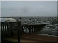
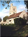
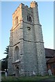
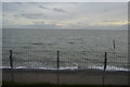
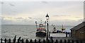
100 photos from this area
Area Information
Key information about the SS9 1DT including its size, population, and administrative classification.
- Area Type
- Postcode
- Area Size
- 5011 m²
- Population
- 1659
- Population Density
- 3062 people/km²
House Prices in SS9 1DT
21
Properties
£322,167
Average Sold Price
£40,000
Lowest Price
£950,000
Highest Price
Showing 21 properties
| Address | Type | Beds | Baths | Last Sale Price | Last Sale Date | |
|---|---|---|---|---|---|---|
| 57 Grand Parade, Leigh On Sea, SS9 1DT | Terraced | 5 | 3 | £950,000 | Apr 2010 | |
| 59 Grand Parade, Leigh On Sea, SS9 1DT | Flat | 2 | 1 | £225,000 | Aug 2005 | |
| 61 Grand Parade, Leigh On Sea, SS9 1DT | Terraced | - | - | £430,000 | Aug 2002 | |
| 59A Grand Parade, Leigh On Sea, SS9 1DT | Flat | - | - | £158,000 | Nov 2001 | |
| 69A Grand Parade, Leigh On Sea, SS9 1DT | Flat | - | - | £130,000 | Jun 2001 | |
| 55 Grand Parade, Leigh On Sea, SS9 1DT | Terraced | - | - | £40,000 | Sep 1996 | |
| 67C Grand Parade, Leigh On Sea, SS9 1DT | Flat | 1 | 1 | - | - | |
| The Cottage, 67 Grand Parade, Leigh On Sea, SS9 1DT | Detached | 2 | 2 | - | - | |
| 7, All Hallows Court, 51 Grand Parade, Leigh On Sea, SS9 1DT | Flat | - | - | - | - | |
| 67E Grand Parade, Leigh On Sea, SS9 1DT | Flat | - | - | - | - |
Page 1 of 3
Energy Efficiency in SS9 1DT
Amenities
Schools
| Rank | School | Type | Entry gender | Ages |
|---|
Explore more schools in this area
Go to Schools tabDemographics
Household Size
One person
most common
Accommodation Type
Flats
most common
Tenure
62
majority
Ethnic Group
White
most common
Religion
N/A
most common
Household Composition
N/A
most common
Age
47
median
Adults (30-64 years)
most common
Household Deprivation
N/A
with no deprivation
NS-SEC
47
in Lower managerial occupations
Explore more demographic insights in this area
Go to Demographics tabPlanning
Planning Constraints
- Flood RiskPremium
- Ramsar Wetland SitesPremium
- Area of Outstanding Natural BeautyPremium
- Protected Nature ReservePremium
- Protected WoodlandPremium