Area Overview for SS8 9TL
Photos of SS8 9TL
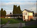
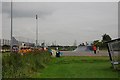
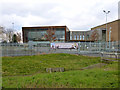
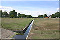
7 photos from this area
Area Information
Key information about the SS8 9TL including its size, population, and administrative classification.
- Area Type
- Postcode
- Area Size
- 5201 m²
- Population
- 1430
- Population Density
- 6642 people/km²
House Prices in SS8 9TL
18
Properties
£205,150
Average Sold Price
£58,995
Lowest Price
£350,000
Highest Price
Showing 18 properties
| Address | Type | Beds | Baths | Last Sale Price | Last Sale Date | |
|---|---|---|---|---|---|---|
| 220 Link Road, Canvey Island, SS8 9TL | Terraced | 3 | 1 | £270,000 | May 2025 | |
| 232 Link Road, Canvey Island, SS8 9TL | Terraced | 3 | 1 | £305,000 | Jul 2024 | |
| 242 Link Road, Canvey Island, SS8 9TL | house | - | - | £350,000 | Apr 2023 | |
| 208 Link Road, Canvey Island, SS8 9TL | house | - | - | £340,000 | Nov 2021 | |
| 224 Link Road, Canvey Island, SS8 9TL | house | - | - | £256,660 | Nov 2019 | |
| 240 Link Road, Canvey Island, SS8 9TL | Terraced | 3 | - | £185,000 | Dec 2014 | |
| 230 Link Road, Canvey Island, SS8 9TL | Terraced | 3 | 1 | £142,500 | May 2013 | |
| 226 Link Road, Canvey Island, SS8 9TL | Flat | - | - | £159,500 | Apr 2008 | |
| 228 Link Road, Canvey Island, SS8 9TL | Terraced | 3 | 1 | £102,000 | Sep 2002 | |
| 234 Link Road, Canvey Island, SS8 9TL | Semi-detached | - | - | £87,000 | Dec 2000 |
Page 1 of 2
Energy Efficiency in SS8 9TL
Amenities
Schools
| Rank | School | Type | Entry gender | Ages |
|---|
Explore more schools in this area
Go to Schools tabDemographics
Household Size
Family (3-5 people)
most common
Accommodation Type
Houses
most common
Tenure
84
majority
Ethnic Group
White
most common
Religion
N/A
most common
Household Composition
N/A
most common
Age
47
median
Adults (30-64 years)
most common
Household Deprivation
N/A
with no deprivation
NS-SEC
30
in Lower managerial occupations
Explore more demographic insights in this area
Go to Demographics tabPlanning
Planning Constraints
- Flood RiskPremium
- Ramsar Wetland SitesPremium
- Area of Outstanding Natural BeautyPremium
- Protected Nature ReservePremium
- Protected WoodlandPremium