Area Overview for SS8 9SS
Photos of SS8 9SS
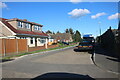
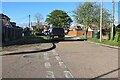
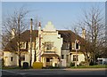
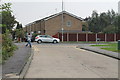
16 photos from this area
Area Information
Key information about the SS8 9SS including its size, population, and administrative classification.
- Area Type
- Postcode
- Area Size
- 3729 m²
- Population
- 1496
- Population Density
- 7388 people/km²
House Prices in SS8 9SS
12
Properties
£163,217
Average Sold Price
£65,500
Lowest Price
£300,000
Highest Price
Showing 12 properties
| Address | Type | Beds | Baths | Last Sale Price | Last Sale Date | |
|---|---|---|---|---|---|---|
| 16 Sixth Avenue, Canvey Island, SS8 9SS | Terraced | 3 | 1 | £300,000 | Sep 2025 | |
| 21 Sixth Avenue, Canvey Island, SS8 9SS | house | - | - | £217,500 | Jun 2021 | |
| 12 Sixth Avenue, Canvey Island, SS8 9SS | house | - | - | £205,000 | Dec 2016 | |
| 22 Sixth Avenue, Canvey Island, SS8 9SS | house | - | - | £169,950 | Jul 2015 | |
| 19 Sixth Avenue, Canvey Island, SS8 9SS | Terraced | - | - | £128,000 | Jul 2012 | |
| 23 Sixth Avenue, Canvey Island, SS8 9SS | house | - | - | £145,000 | Oct 2007 | |
| 15 Sixth Avenue, Canvey Island, SS8 9SS | Terraced | 3 | 1 | £118,000 | Sep 2007 | |
| 14 Sixth Avenue, Canvey Island, SS8 9SS | Terraced | 3 | 1 | £120,000 | Nov 2003 | |
| 18 Sixth Avenue, Canvey Island, SS8 9SS | Terraced | - | - | £65,500 | Aug 1999 | |
| Cartref, Link Road, Canvey Island, SS8 9SS | undefined | - | - | - | - |
Page 1 of 2
Energy Efficiency in SS8 9SS
Amenities
Schools
| Rank | School | Type | Entry gender | Ages |
|---|
Explore more schools in this area
Go to Schools tabDemographics
Household Size
Family (3-5 people)
most common
Accommodation Type
Houses
most common
Tenure
41
majority
Ethnic Group
White
most common
Religion
N/A
most common
Household Composition
N/A
most common
Age
47
median
Adults (30-64 years)
most common
Household Deprivation
N/A
with no deprivation
NS-SEC
18
in Lower managerial occupations
Explore more demographic insights in this area
Go to Demographics tabPlanning
Planning Constraints
- Flood RiskPremium
- Ramsar Wetland SitesPremium
- Area of Outstanding Natural BeautyPremium
- Protected Nature ReservePremium
- Protected WoodlandPremium