Area Overview for SS8 8JH
Photos of SS8 8JH
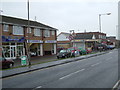
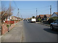
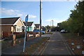
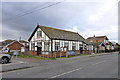
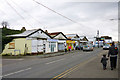
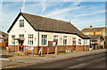
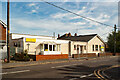
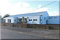
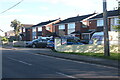
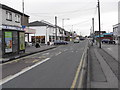
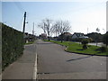
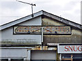
14 photos from this area
Area Information
Key information about the SS8 8JH including its size, population, and administrative classification.
- Area Type
- Postcode
- Area Size
- 8049 m²
- Population
- 1414
- Population Density
- 4662 people/km²
House Prices in SS8 8JH
19
Properties
£208,312
Average Sold Price
£147,000
Lowest Price
£332,000
Highest Price
Showing 19 properties
| Address | Type | Beds | Baths | Last Sale Price | Last Sale Date | |
|---|---|---|---|---|---|---|
| 50 Smallgains Avenue, Canvey Island, SS8 8JH | Semi-detached | 3 | 2 | £332,000 | Jul 2023 | |
| 26 Smallgains Avenue, Canvey Island, SS8 8JH | Semi-detached | 1 | 1 | £225,000 | Apr 2023 | |
| 62 Smallgains Avenue, Canvey Island, SS8 8JH | Detached | 2 | 1 | £206,000 | Aug 2018 | |
| 52 Smallgains Avenue, Canvey Island, SS8 8JH | Semi-detached | 5 | - | £225,000 | Sep 2014 | |
| 46 Smallgains Avenue, Canvey Island, SS8 8JH | Semi-detached | 2 | - | £197,500 | May 2012 | |
| 38 Smallgains Avenue, Canvey Island, SS8 8JH | Bungalow | 2 | - | £147,000 | Mar 2011 | |
| 48 Smallgains Avenue, Canvey Island, SS8 8JH | Semi-detached | 2 | - | £184,000 | Jun 2007 | |
| 36 Smallgains Avenue, Canvey Island, SS8 8JH | Semi-detached | - | - | £149,995 | Dec 2002 | |
| 30 Smallgains Avenue, Canvey Island, SS8 8JH | Bungalow | - | - | - | - | |
| 28 Smallgains Avenue, Canvey Island, SS8 8JH | Bungalow | - | - | - | - |
Page 1 of 2
Energy Efficiency in SS8 8JH
Amenities
Schools
| Rank | School | Type | Entry gender | Ages |
|---|
Explore more schools in this area
Go to Schools tabDemographics
Household Size
Two person
most common
Accommodation Type
Houses
most common
Tenure
75
majority
Ethnic Group
White
most common
Religion
N/A
most common
Household Composition
N/A
most common
Age
47
median
Adults (30-64 years)
most common
Household Deprivation
N/A
with no deprivation
NS-SEC
23
in Lower managerial occupations
Explore more demographic insights in this area
Go to Demographics tabPlanning
Planning Constraints
- Flood RiskPremium
- Ramsar Wetland SitesPremium
- Area of Outstanding Natural BeautyPremium
- Protected Nature ReservePremium
- Protected WoodlandPremium