Area Overview for SS8 7JL
Photos of SS8 7JL
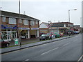
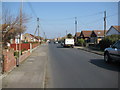
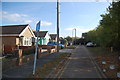
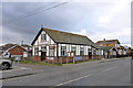
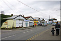
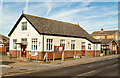
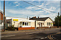
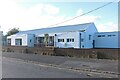
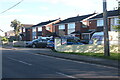
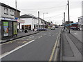
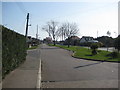
14 photos from this area
Area Information
Key information about the SS8 7JL including its size, population, and administrative classification.
- Area Type
- Postcode
- Area Size
- 9138 m²
- Population
- 1513
- Population Density
- 6430 people/km²
House Prices in SS8 7JL
30
Properties
£250,131
Average Sold Price
£145,000
Lowest Price
£390,000
Highest Price
Showing 30 properties
| Address | Type | Beds | Baths | Last Sale Price | Last Sale Date | |
|---|---|---|---|---|---|---|
| 33 Maurice Road, Canvey Island, SS8 7JL | Bungalow | 1 | 1 | £245,000 | Jun 2025 | |
| 41 Maurice Road, Canvey Island, SS8 7JL | Bungalow | 1 | 1 | £260,000 | Sep 2024 | |
| 41A Maurice Road, Canvey Island, SS8 7JL | Bungalow | 1 | 2 | £277,000 | Jan 2024 | |
| 29 Maurice Road, Canvey Island, SS8 7JL | Bungalow | - | - | £300,000 | Apr 2022 | |
| 11 Maurice Road, Canvey Island, SS8 7JL | Bungalow | 3 | - | £390,000 | Mar 2022 | |
| 25 Maurice Road, Canvey Island, SS8 7JL | Detached | 2 | 1 | £310,000 | Nov 2021 | |
| 19 Maurice Road, Canvey Island, SS8 7JL | Bungalow | - | - | £290,000 | Oct 2021 | |
| 37 Maurice Road, Canvey Island, SS8 7JL | Bungalow | - | - | £270,000 | Sep 2021 | |
| 21 Maurice Road, Canvey Island, SS8 7JL | Bungalow | 2 | 1 | £285,000 | May 2021 | |
| 5 Maurice Road, Canvey Island, SS8 7JL | Bungalow | 2 | 1 | £275,000 | Feb 2020 |
Page 1 of 3
Energy Efficiency in SS8 7JL
Amenities
Schools
| Rank | School | Type | Entry gender | Ages |
|---|
Explore more schools in this area
Go to Schools tabDemographics
Household Size
Two person
most common
Accommodation Type
Houses
most common
Tenure
83
majority
Ethnic Group
White
most common
Religion
N/A
most common
Household Composition
N/A
most common
Age
47
median
Adults (30-64 years)
most common
Household Deprivation
N/A
with no deprivation
NS-SEC
24
in Lower managerial occupations
Explore more demographic insights in this area
Go to Demographics tabPlanning
Planning Constraints
- Flood RiskPremium
- Ramsar Wetland SitesPremium
- Area of Outstanding Natural BeautyPremium
- Protected Nature ReservePremium
- Protected WoodlandPremium