Area Overview for SS8 7DR
Photos of SS8 7DR

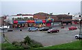
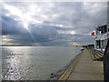
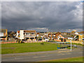
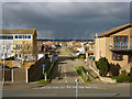
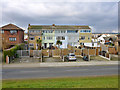
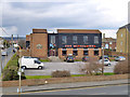
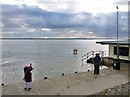
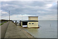
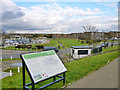
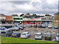
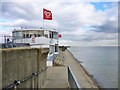
74 photos from this area
Area Information
Key information about the SS8 7DR including its size, population, and administrative classification.
- Area Type
- Postcode
- Area Size
- 1.2 hectares
- Population
- 1582
- Population Density
- 4752 people/km²
House Prices in SS8 7DR
14
Properties
£186,150
Average Sold Price
£60,000
Lowest Price
£260,000
Highest Price
Showing 14 properties
| Address | Type | Beds | Baths | Last Sale Price | Last Sale Date | |
|---|---|---|---|---|---|---|
| 276 Furtherwick Road, Canvey Island, SS8 7DR | Semi-detached | 3 | 1 | £260,000 | Mar 2017 | |
| 262 Furtherwick Road, Canvey Island, SS8 7DR | house | 3 | - | £249,000 | Mar 2016 | |
| 268 Furtherwick Road, Canvey Island, SS8 7DR | Detached | 3 | 1 | £254,000 | Mar 2016 | |
| 264 Furtherwick Road, Canvey Island, SS8 7DR | house | - | - | £195,000 | Dec 2012 | |
| 270 Furtherwick Road, Canvey Island, SS8 7DR | Detached | 4 | - | £210,000 | Sep 2010 | |
| 288 Furtherwick Road, Canvey Island, SS8 7DR | Detached | 4 | 2 | £235,000 | Sep 2008 | |
| 280 Furtherwick Road, Canvey Island, SS8 7DR | Semi-detached | - | - | £170,000 | Oct 2006 | |
| 278 Furtherwick Road, Canvey Island, SS8 7DR | house | - | - | £130,500 | Apr 2003 | |
| 282 Furtherwick Road, Canvey Island, SS8 7DR | Semi-detached | - | - | £97,995 | Nov 2001 | |
| 266 Furtherwick Road, Canvey Island, SS8 7DR | Flat | - | - | £60,000 | Mar 1996 |
Page 1 of 2
Energy Efficiency in SS8 7DR
Amenities
Schools
| Rank | School | Type | Entry gender | Ages |
|---|
Explore more schools in this area
Go to Schools tabDemographics
Household Size
Two person
most common
Accommodation Type
Houses
most common
Tenure
86
majority
Ethnic Group
White
most common
Religion
N/A
most common
Household Composition
N/A
most common
Age
47
median
Adults (30-64 years)
most common
Household Deprivation
N/A
with no deprivation
NS-SEC
27
in Lower managerial occupations
Explore more demographic insights in this area
Go to Demographics tabPlanning
Planning Constraints
- Flood RiskPremium
- Ramsar Wetland SitesPremium
- Area of Outstanding Natural BeautyPremium
- Protected Nature ReservePremium
- Protected WoodlandPremium