Area Overview for SS7 4NH
Photos of SS7 4NH
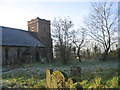
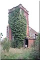
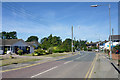
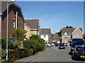

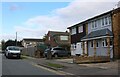
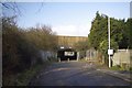
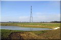
17 photos from this area
Area Information
Key information about the SS7 4NH including its size, population, and administrative classification.
- Area Type
- Postcode
- Area Size
- 8786 m²
- Population
- 1537
- Population Density
- 8478 people/km²
House Prices in SS7 4NH
25
Properties
£226,388
Average Sold Price
£59,000
Lowest Price
£420,000
Highest Price
Showing 25 properties
| Address | Type | Beds | Baths | Last Sale Price | Last Sale Date | |
|---|---|---|---|---|---|---|
| 173 Woodside Avenue, Thundersley, Benfleet, SS7 4NH | Semi-detached | 3 | 1 | £390,000 | Aug 2023 | |
| 169 Woodside Avenue, Thundersley, Benfleet, SS7 4NH | Semi-detached | 3 | 1 | £406,000 | Dec 2022 | |
| 137 Woodside Avenue, Thundersley, Benfleet, SS7 4NH | Terraced | 3 | 1 | £332,500 | Feb 2022 | |
| 171 Woodside Avenue, Thundersley, Benfleet, SS7 4NH | Semi-detached | 4 | - | £420,000 | Mar 2021 | |
| 143 Woodside Avenue, Thundersley, Benfleet, SS7 4NH | Semi-detached | 3 | 1 | £315,000 | Sep 2020 | |
| 181 Woodside Avenue, Thundersley, Benfleet, SS7 4NH | Detached | 4 | - | £357,500 | Oct 2014 | |
| 163 Woodside Avenue, Thundersley, Benfleet, SS7 4NH | Semi-detached | - | - | £235,000 | Apr 2014 | |
| 121 Woodside Avenue, Thundersley, Benfleet, SS7 4NH | Terraced | 3 | 1 | £185,000 | May 2013 | |
| 119 Woodside Avenue, Thundersley, Benfleet, SS7 4NH | house | 3 | - | £190,000 | Sep 2012 | |
| 165 Woodside Avenue, Thundersley, Benfleet, SS7 4NH | Semi-detached | 3 | 1 | £220,000 | Sep 2010 |
Page 1 of 3
Energy Efficiency in SS7 4NH
Amenities
Schools
| Rank | School | Type | Entry gender | Ages |
|---|
Explore more schools in this area
Go to Schools tabDemographics
Household Size
Family (3-5 people)
most common
Accommodation Type
Houses
most common
Tenure
79
majority
Ethnic Group
White
most common
Religion
N/A
most common
Household Composition
N/A
most common
Age
47
median
Adults (30-64 years)
most common
Household Deprivation
N/A
with no deprivation
NS-SEC
29
in Lower managerial occupations
Explore more demographic insights in this area
Go to Demographics tabPlanning
Planning Constraints
- Flood RiskPremium
- Ramsar Wetland SitesPremium
- Area of Outstanding Natural BeautyPremium
- Protected Nature ReservePremium
- Protected WoodlandPremium