Area Overview for SS7 3AY
Photos of SS7 3AY
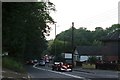


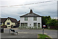
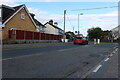

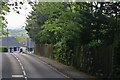
28 photos from this area
Area Information
Key information about the SS7 3AY including its size, population, and administrative classification.
- Area Type
- Postcode
- Area Size
- 1.8 hectares
- Population
- 1522
- Population Density
- 3979 people/km²
House Prices in SS7 3AY
47
Properties
£254,857
Average Sold Price
£59,995
Lowest Price
£435,000
Highest Price
Showing 47 properties
| Address | Type | Beds | Baths | Last Sale Price | Last Sale Date | |
|---|---|---|---|---|---|---|
| 51 Kings Park, Thundersley, Benfleet, SS7 3AY | Detached | 3 | 1 | £435,000 | Sep 2025 | |
| 26 Kings Park, Thundersley, Benfleet, SS7 3AY | Semi-detached | 2 | 1 | £425,000 | Feb 2025 | |
| 35 Kings Park, Thundersley, Benfleet, SS7 3AY | Semi-detached | 3 | 1 | £385,000 | Sep 2024 | |
| 47 Kings Park, Thundersley, Benfleet, SS7 3AY | Detached | 4 | 3 | £360,000 | Jan 2024 | |
| 9 Kings Park, Thundersley, Benfleet, SS7 3AY | house | - | - | £400,000 | Jul 2023 | |
| 2 Kings Park, Thundersley, Benfleet, SS7 3AY | Bungalow | 4 | 3 | £412,500 | Jun 2022 | |
| 24 Kings Park, Thundersley, Benfleet, SS7 3AY | Bungalow | - | - | £345,000 | Dec 2021 | |
| 8 Kings Park, Thundersley, Benfleet, SS7 3AY | Terraced | - | - | £178,720 | Oct 2020 | |
| 55 Kings Park, Thundersley, Benfleet, SS7 3AY | house | - | - | £345,500 | Jun 2020 | |
| 45 Kings Park, Thundersley, Benfleet, SS7 3AY | Detached | 3 | 1 | £380,000 | Sep 2019 |
Page 1 of 5
Energy Efficiency in SS7 3AY
Amenities
Schools
| Rank | School | Type | Entry gender | Ages |
|---|
Explore more schools in this area
Go to Schools tabDemographics
Household Size
Two person
most common
Accommodation Type
Houses
most common
Tenure
86
majority
Ethnic Group
White
most common
Religion
N/A
most common
Household Composition
N/A
most common
Age
47
median
Adults (30-64 years)
most common
Household Deprivation
N/A
with no deprivation
NS-SEC
33
in Lower managerial occupations
Explore more demographic insights in this area
Go to Demographics tabPlanning
Planning Constraints
- Flood RiskPremium
- Ramsar Wetland SitesPremium
- Area of Outstanding Natural BeautyPremium
- Protected Nature ReservePremium
- Protected WoodlandPremium