Area Overview for SS6 9HZ
Photos of SS6 9HZ


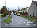


41 photos from this area
Area Information
Key information about the SS6 9HZ including its size, population, and administrative classification.
- Area Type
- Postcode
- Area Size
- 8597 m²
- Population
- 2087
- Population Density
- 4208 people/km²
House Prices in SS6 9HZ
25
Properties
£223,595
Average Sold Price
£64,995
Lowest Price
£365,000
Highest Price
Showing 25 properties
| Address | Type | Beds | Baths | Last Sale Price | Last Sale Date | |
|---|---|---|---|---|---|---|
| 48 Langdon Road, Rayleigh, SS6 9HZ | Detached | 2 | 1 | £342,500 | Jul 2025 | |
| 22 Langdon Road, Rayleigh, SS6 9HZ | Semi-detached | 2 | 1 | £320,000 | Dec 2023 | |
| 8 Langdon Road, Rayleigh, SS6 9HZ | Bungalow | 2 | - | £360,000 | Dec 2021 | |
| 36 Langdon Road, Rayleigh, SS6 9HZ | Bungalow | - | - | £365,000 | Aug 2021 | |
| 44 Langdon Road, Rayleigh, SS6 9HZ | Bungalow | 2 | 1 | £295,000 | Sep 2019 | |
| 30 Langdon Road, Rayleigh, SS6 9HZ | Bungalow | 2 | - | £325,000 | Jan 2018 | |
| 38 Langdon Road, Rayleigh, SS6 9HZ | Bungalow | - | - | £275,000 | Mar 2016 | |
| 26 Langdon Road, Rayleigh, SS6 9HZ | Bungalow | - | - | £200,000 | May 2015 | |
| 24 Langdon Road, Rayleigh, SS6 9HZ | Bungalow | - | - | £220,000 | Sep 2014 | |
| 20 Langdon Road, Rayleigh, SS6 9HZ | Semi-detached | 2 | - | £188,000 | Mar 2014 |
Page 1 of 3
Energy Efficiency in SS6 9HZ
Amenities
Schools
| Rank | School | Type | Entry gender | Ages |
|---|
Explore more schools in this area
Go to Schools tabDemographics
Household Size
Family (3-5 people)
most common
Accommodation Type
Houses
most common
Tenure
80
majority
Ethnic Group
White
most common
Religion
N/A
most common
Household Composition
N/A
most common
Age
47
median
Adults (30-64 years)
most common
Household Deprivation
N/A
with no deprivation
NS-SEC
38
in Lower managerial occupations
Explore more demographic insights in this area
Go to Demographics tabPlanning
Planning Constraints
- Flood RiskPremium
- Ramsar Wetland SitesPremium
- Area of Outstanding Natural BeautyPremium
- Protected Nature ReservePremium
- Protected WoodlandPremium