Area Overview for SS6 9DT
Photos of SS6 9DT


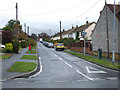


41 photos from this area
Area Information
Key information about the SS6 9DT including its size, population, and administrative classification.
- Area Type
- Postcode
- Area Size
- 7.2 hectares
- Population
- 2193
- Population Density
- 190 people/km²
House Prices in SS6 9DT
22
Properties
£430,677
Average Sold Price
£249,000
Lowest Price
£875,000
Highest Price
Showing 22 properties
| Address | Type | Beds | Baths | Last Sale Price | Last Sale Date | |
|---|---|---|---|---|---|---|
| 202 London Road, Rayleigh, SS6 9DT | Detached | 3 | 2 | £442,000 | Dec 2023 | |
| Pearsons Farm, London Road, Rayleigh, SS6 9DT | Detached | 3 | 1 | £875,000 | Jun 2021 | |
| 156 London Road, Rayleigh, SS6 9DT | Terraced | 3 | 1 | £411,000 | Jan 2021 | |
| 158 London Road, Rayleigh, SS6 9DT | house | 5 | - | £330,000 | Oct 2016 | |
| 160 London Road, Rayleigh, SS6 9DT | house | - | - | £294,000 | Jun 2015 | |
| 192 London Road, Rayleigh, SS6 9DT | house | 3 | - | £450,000 | Apr 2015 | |
| 152 London Road, Rayleigh, SS6 9DT | Semi-detached | 3 | 1 | £249,000 | Jan 2015 | |
| 196 London Road, Rayleigh, SS6 9DT | Detached | 5 | - | £430,000 | Dec 2014 | |
| 194 London Road, Rayleigh, SS6 9DT | Detached | 5 | - | £484,995 | Aug 2014 | |
| 198 London Road, Rayleigh, SS6 9DT | house | - | - | £446,500 | Aug 2013 |
Page 1 of 3
Energy Efficiency in SS6 9DT
Amenities
Schools
| Rank | School | Type | Entry gender | Ages |
|---|
Explore more schools in this area
Go to Schools tabDemographics
Household Size
Family (3-5 people)
most common
Accommodation Type
Houses
most common
Tenure
80
majority
Ethnic Group
White
most common
Religion
N/A
most common
Household Composition
N/A
most common
Age
47
median
Adults (30-64 years)
most common
Household Deprivation
N/A
with no deprivation
NS-SEC
40
in Lower managerial occupations
Explore more demographic insights in this area
Go to Demographics tabPlanning
Planning Constraints
- Flood RiskPremium
- Ramsar Wetland SitesPremium
- Area of Outstanding Natural BeautyPremium
- Protected Nature ReservePremium
- Protected WoodlandPremium