Area Overview for SS6 8SQ
Photos of SS6 8SQ
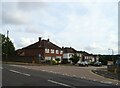
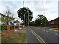
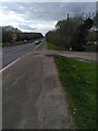
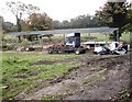
22 photos from this area
Area Information
Key information about the SS6 8SQ including its size, population, and administrative classification.
- Area Type
- Postcode
- Area Size
- 1.5 hectares
- Population
- 1232
- Population Density
- 3976 people/km²
House Prices in SS6 8SQ
37
Properties
£366,857
Average Sold Price
£135,000
Lowest Price
£650,000
Highest Price
Showing 37 properties
| Address | Type | Beds | Baths | Last Sale Price | Last Sale Date | |
|---|---|---|---|---|---|---|
| 30 Clarence Road, Rayleigh, SS6 8SQ | Bungalow | 3 | 1 | £468,000 | Mar 2023 | |
| 68 Clarence Road, Rayleigh, SS6 8SQ | Detached | 4 | 2 | £635,000 | Jul 2022 | |
| 48 Clarence Road, Rayleigh, SS6 8SQ | house | - | - | £650,000 | Apr 2021 | |
| 38 Clarence Road, Rayleigh, SS6 8SQ | Bungalow | 3 | 1 | £435,000 | Aug 2020 | |
| 50 Clarence Road, Rayleigh, SS6 8SQ | house | - | - | £590,000 | Jul 2017 | |
| 72 Clarence Road, Rayleigh, SS6 8SQ | Detached | 3 | 1 | £335,000 | Feb 2015 | |
| 32 Clarence Road, Rayleigh, SS6 8SQ | Detached | 4 | 2 | £343,000 | Dec 2012 | |
| 36 Clarence Road, Rayleigh, SS6 8SQ | Detached | - | - | £325,000 | Jul 2007 | |
| 56 Clarence Road, Rayleigh, SS6 8SQ | Detached | - | - | £310,000 | Mar 2006 | |
| 46 Clarence Road, Rayleigh, SS6 8SQ | Bungalow | 3 | 1 | £275,000 | Nov 2004 |
Page 1 of 4
Energy Efficiency in SS6 8SQ
Amenities
Schools
| Rank | School | Type | Entry gender | Ages |
|---|
Explore more schools in this area
Go to Schools tabDemographics
Household Size
Two person
most common
Accommodation Type
Houses
most common
Tenure
89
majority
Ethnic Group
White
most common
Religion
N/A
most common
Household Composition
N/A
most common
Age
47
median
Adults (30-64 years)
most common
Household Deprivation
N/A
with no deprivation
NS-SEC
38
in Lower managerial occupations
Explore more demographic insights in this area
Go to Demographics tabPlanning
Planning Constraints
- Flood RiskPremium
- Ramsar Wetland SitesPremium
- Area of Outstanding Natural BeautyPremium
- Protected Nature ReservePremium
- Protected WoodlandPremium