Area Overview for SS5 5JX
Photos of SS5 5JX
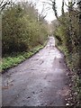
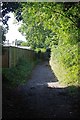
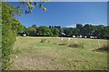
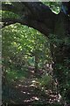
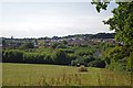

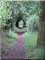
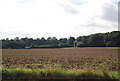
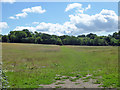
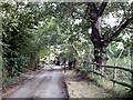
10 photos from this area
Area Information
Key information about the SS5 5JX including its size, population, and administrative classification.
- Area Type
- Postcode
- Area Size
- 10.0 hectares
- Population
- 2008
- Population Density
- 207 people/km²
House Prices in SS5 5JX
11
Properties
£950,000
Average Sold Price
£625,000
Lowest Price
£1,275,000
Highest Price
Showing 11 properties
| Address | Type | Beds | Baths | Last Sale Price | Last Sale Date | |
|---|---|---|---|---|---|---|
| Northcroft, New Park Road, Hockley, SS5 5JX | Bungalow | 5 | 4 | £1,275,000 | May 2024 | |
| Hillside, New Park Road, Hockley, SS5 5JX | Detached | 3 | 2 | £625,000 | Sep 2018 | |
| LAND END OF OAKFIELD ROAD, NEW PARK ROAD, Hockley, SS5 5JX | Mobile Home | - | - | - | - | |
| OAKLANDS, NEW PARK ROAD, Hockley, SS5 5JX | Mobile Home | - | - | - | - | |
| Caravan 3, The Pear Tree 750, New Park Road, Hockley, SS5 5JX | Mobile Home | - | - | - | - | |
| Caravan 2, The Pear Tree 750, New Park Road, Hockley, SS5 5JX | Mobile Home | - | - | - | - | |
| Caravans 1 And 3, The Pear Tree 750, New Park Road, Hockley, SS5 5JX | Mobile Home | - | - | - | - | |
| Caravan At Alernpaul, New Park Road, Hockley, SS5 5JX | Mobile Home | - | - | - | - | |
| Abbey Grove, New Park Road, Hockley, SS5 5JX | Detached | - | - | - | - | |
| Alernpaul, New Park Road, Hockley, SS5 5JX | Detached | - | - | - | - |
Page 1 of 2
Energy Efficiency in SS5 5JX
Amenities
Schools
| Rank | School | Type | Entry gender | Ages |
|---|
Explore more schools in this area
Go to Schools tabDemographics
Household Size
Two person
most common
Accommodation Type
Houses
most common
Tenure
91
majority
Ethnic Group
White
most common
Religion
N/A
most common
Household Composition
N/A
most common
Age
47
median
Adults (30-64 years)
most common
Household Deprivation
N/A
with no deprivation
NS-SEC
36
in Lower managerial occupations
Explore more demographic insights in this area
Go to Demographics tabPlanning
Planning Constraints
- Flood RiskPremium
- Ramsar Wetland SitesPremium
- Area of Outstanding Natural BeautyPremium
- Protected Nature ReservePremium
- Protected WoodlandPremium