Area Overview for SS5 5AY
Photos of SS5 5AY
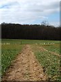
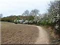
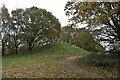
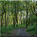
10 photos from this area
Area Information
Key information about the SS5 5AY including its size, population, and administrative classification.
- Area Type
- Postcode
- Area Size
- 14.3 hectares
- Population
- 1994
- Population Density
- 1589 people/km²
House Prices in SS5 5AY
32
Properties
£261,969
Average Sold Price
£165,000
Lowest Price
£420,000
Highest Price
Showing 32 properties
| Address | Type | Beds | Baths | Last Sale Price | Last Sale Date | |
|---|---|---|---|---|---|---|
| 17 Appleyard Avenue, Hockley, SS5 5AY | Semi-detached | 3 | 2 | £420,000 | Nov 2022 | |
| 6 Appleyard Avenue, Hockley, SS5 5AY | Semi-detached | 2 | 1 | £386,250 | Nov 2022 | |
| 19 Appleyard Avenue, Hockley, SS5 5AY | Semi-detached | 3 | 1 | £340,000 | Oct 2017 | |
| 7 Appleyard Avenue, Hockley, SS5 5AY | Bungalow | 3 | 1 | £217,500 | Nov 2012 | |
| 8 Appleyard Avenue, Hockley, SS5 5AY | Bungalow | - | - | £165,000 | Dec 2011 | |
| 2 Appleyard Avenue, Hockley, SS5 5AY | Bungalow | - | - | £175,000 | Aug 2009 | |
| 30 Appleyard Avenue, Hockley, SS5 5AY | house | - | - | £215,000 | Feb 2007 | |
| 23 Appleyard Avenue, Hockley, SS5 5AY | Semi-detached | - | - | £177,000 | Oct 2005 | |
| 28 Appleyard Avenue, Hockley, SS5 5AY | Detached | 2 | 1 | - | - | |
| 36 Appleyard Avenue, Hockley, SS5 5AY | Semi-detached | 3 | 1 | - | - |
Page 1 of 4
Energy Efficiency in SS5 5AY
Amenities
Schools
| Rank | School | Type | Entry gender | Ages |
|---|
Explore more schools in this area
Go to Schools tabDemographics
Household Size
Family (3-5 people)
most common
Accommodation Type
Houses
most common
Tenure
89
majority
Ethnic Group
White
most common
Religion
N/A
most common
Household Composition
N/A
most common
Age
47
median
Adults (30-64 years)
most common
Household Deprivation
N/A
with no deprivation
NS-SEC
39
in Lower managerial occupations
Explore more demographic insights in this area
Go to Demographics tabPlanning
Planning Constraints
- Flood RiskPremium
- Ramsar Wetland SitesPremium
- Area of Outstanding Natural BeautyPremium
- Protected Nature ReservePremium
- Protected WoodlandPremium