Area Overview for SS4 3LW
Photos of SS4 3LW
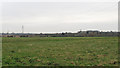
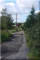
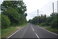
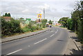
13 photos from this area
Area Information
Key information about the SS4 3LW including its size, population, and administrative classification.
- Area Type
- Postcode
- Area Size
- 30.2 hectares
- Population
- 2008
- Population Density
- 207 people/km²
House Prices in SS4 3LW
15
Properties
£310,000
Average Sold Price
£310,000
Lowest Price
£310,000
Highest Price
Showing 15 properties
| Address | Type | Beds | Baths | Last Sale Price | Last Sale Date | |
|---|---|---|---|---|---|---|
| Lowlands, Fambridge Road, Ashingdon, SS4 3LW | Bungalow | 2 | 2 | £310,000 | Jun 2018 | |
| Heimat, Fambridge Road, Ashingdon, SS4 3LW | Bungalow | 2 | 2 | - | - | |
| M I X, The Cabin, Rectory Farm, Fambridge Road, South Fambridge, SS4 3LW | Office | - | - | - | - | |
| Stables At, Land Rear Of Greenaways, Lyndhurst Road, Ashingdon, SS4 3LW | Equestrian | - | - | - | - | |
| Property At, Land West Of Track Between Lyndhurst Road And, Canewdon Road, Ashingdon, SS4 3LW | Detached | - | - | - | - | |
| Caravan B, Land Rear Of Greenaways, Lyndhurst Road, Ashingdon, SS4 3LW | Mobile Home | - | - | - | - | |
| Caravan A, Land Rear Of Greenaways, Lyndhurst Road, Ashingdon, SS4 3LW | Mobile Home | - | - | - | - | |
| The Cottage, Fambridge Road, Ashingdon, SS4 3LW | Semi-detached | - | - | - | - | |
| Plemont, Fambridge Road, Ashingdon, SS4 3LW | Semi-detached | - | - | - | - | |
| Royston, Fambridge Road, Ashingdon, SS4 3LW | Semi-detached | - | - | - | - |
Page 1 of 2
Energy Efficiency in SS4 3LW
Amenities
Schools
| Rank | School | Type | Entry gender | Ages |
|---|
Explore more schools in this area
Go to Schools tabDemographics
Household Size
Two person
most common
Accommodation Type
Houses
most common
Tenure
91
majority
Ethnic Group
White
most common
Religion
N/A
most common
Household Composition
N/A
most common
Age
47
median
Adults (30-64 years)
most common
Household Deprivation
N/A
with no deprivation
NS-SEC
36
in Lower managerial occupations
Explore more demographic insights in this area
Go to Demographics tabPlanning
Planning Constraints
- Flood RiskPremium
- Ramsar Wetland SitesPremium
- Area of Outstanding Natural BeautyPremium
- Protected Nature ReservePremium
- Protected WoodlandPremium