Area Overview for SS3 9RJ
Photos of SS3 9RJ

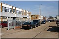
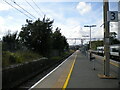

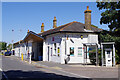
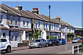
34 photos from this area
Area Information
Key information about the SS3 9RJ including its size, population, and administrative classification.
- Area Type
- Postcode
- Area Size
- 2.6 hectares
- Population
- 1522
- Population Density
- 6853 people/km²
House Prices in SS3 9RJ
55
Properties
£166,710
Average Sold Price
£38,750
Lowest Price
£247,500
Highest Price
Showing 55 properties
| Address | Type | Beds | Baths | Last Sale Price | Last Sale Date | |
|---|---|---|---|---|---|---|
| 28 Eagle Way, Shoeburyness, Southend On Sea, SS3 9RJ | Terraced | 3 | 1 | £220,000 | Jul 2024 | |
| 46 Eagle Way, Shoeburyness, Southend On Sea, SS3 9RJ | house | 3 | 1 | £230,000 | Jul 2022 | |
| 56 Eagle Way, Shoeburyness, Southend On Sea, SS3 9RJ | house | - | - | £247,500 | Feb 2022 | |
| 6 Eagle Way, Shoeburyness, Southend On Sea, SS3 9RJ | house | - | - | £170,800 | Jan 2022 | |
| 32 Eagle Way, Shoeburyness, Southend On Sea, SS3 9RJ | house | 3 | 2 | £227,500 | Jan 2021 | |
| 14 Eagle Way, Shoeburyness, Southend On Sea, SS3 9RJ | Terraced | 3 | 1 | £210,100 | Jan 2020 | |
| 10 Eagle Way, Shoeburyness, Southend On Sea, SS3 9RJ | Terraced | 3 | 1 | £230,000 | Aug 2019 | |
| 38 Eagle Way, Shoeburyness, Southend On Sea, SS3 9RJ | Terraced | 3 | 1 | £200,000 | Jan 2019 | |
| 54 Eagle Way, Shoeburyness, Southend On Sea, SS3 9RJ | Terraced | 3 | 1 | £215,000 | Jul 2018 | |
| 120 Eagle Way, Shoeburyness, Southend On Sea, SS3 9RJ | house | - | - | £246,000 | Jan 2015 |
Page 1 of 6
Energy Efficiency in SS3 9RJ
Amenities
Schools
| Rank | School | Type | Entry gender | Ages |
|---|
Explore more schools in this area
Go to Schools tabDemographics
Household Size
One person
most common
Accommodation Type
Houses
most common
Tenure
35
majority
Ethnic Group
White
most common
Religion
N/A
most common
Household Composition
N/A
most common
Age
47
median
Adults (30-64 years)
most common
Household Deprivation
N/A
with no deprivation
NS-SEC
20
in Lower managerial occupations
Explore more demographic insights in this area
Go to Demographics tabPlanning
Planning Constraints
- Flood RiskPremium
- Ramsar Wetland SitesPremium
- Area of Outstanding Natural BeautyPremium
- Protected Nature ReservePremium
- Protected WoodlandPremium