Area Overview for SS3 0AG
Photos of SS3 0AG
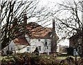
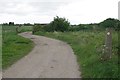

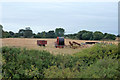
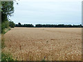
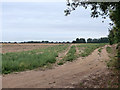
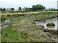
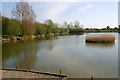
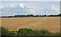
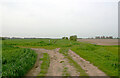
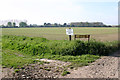
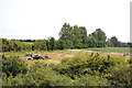
15 photos from this area
Area Information
Key information about the SS3 0AG including its size, population, and administrative classification.
- Area Type
- Postcode
- Area Size
- 21.8 hectares
- Population
- 1325
- Population Density
- 1484 people/km²
House Prices in SS3 0AG
15
Properties
£405,000
Average Sold Price
£180,000
Lowest Price
£650,000
Highest Price
Showing 15 properties
| Address | Type | Beds | Baths | Last Sale Price | Last Sale Date | |
|---|---|---|---|---|---|---|
| Sunnyside Lodge, Common Road, Great Wakering, SS3 0AG | Detached | 4 | 2 | £585,000 | Jun 2025 | |
| Waters Edge, Common Road, Great Wakering, SS3 0AG | Terraced | 3 | 2 | £395,000 | Aug 2020 | |
| Cottawight, Common Road, Great Wakering, SS3 0AG | Detached | 4 | 3 | £650,000 | Jul 2015 | |
| The Oysters, Common Road, Great Wakering, SS3 0AG | Bungalow | - | - | £400,000 | Oct 2013 | |
| Fair Winds, Common Road, Great Wakering, SS3 0AG | Bungalow | - | - | £335,000 | Oct 2013 | |
| Casa Mia, Common Road, Great Wakering, SS3 0AG | Terraced | - | - | £290,000 | Jul 2008 | |
| Chestnut Lodge, Common Road, Great Wakering, SS3 0AG | Detached | - | - | £180,000 | Apr 1998 | |
| Banjo Lodge, Common Road, Great Wakering, SS3 0AG | Detached | 4 | 2 | - | - | |
| Home Farm, Common Road, Great Wakering, SS3 0AG | Detached | 7 | 2 | - | - | |
| Land Adjacent 7, New Road, Great Wakering, SS3 0AG | commercial | - | - | - | - |
Page 1 of 2
Energy Efficiency in SS3 0AG
Amenities
Schools
| Rank | School | Type | Entry gender | Ages |
|---|
Explore more schools in this area
Go to Schools tabDemographics
Household Size
Family (3-5 people)
most common
Accommodation Type
Houses
most common
Tenure
86
majority
Ethnic Group
White
most common
Religion
N/A
most common
Household Composition
N/A
most common
Age
47
median
Adults (30-64 years)
most common
Household Deprivation
N/A
with no deprivation
NS-SEC
33
in Lower managerial occupations
Explore more demographic insights in this area
Go to Demographics tabPlanning
Planning Constraints
- Flood RiskPremium
- Ramsar Wetland SitesPremium
- Area of Outstanding Natural BeautyPremium
- Protected Nature ReservePremium
- Protected WoodlandPremium