Area Overview for SS2 6NX
Photos of SS2 6NX

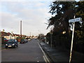
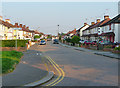

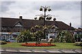
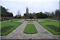

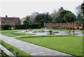

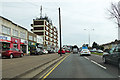
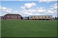
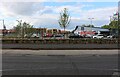
39 photos from this area
Area Information
Key information about the SS2 6NX including its size, population, and administrative classification.
- Area Type
- Postcode
- Area Size
- 1.6 hectares
- Population
- 1575
- Population Density
- 3614 people/km²
House Prices in SS2 6NX
35
Properties
£319,577
Average Sold Price
£73,000
Lowest Price
£525,000
Highest Price
Showing 35 properties
| Address | Type | Beds | Baths | Last Sale Price | Last Sale Date | |
|---|---|---|---|---|---|---|
| 30 Parkstone Drive, Southend On Sea, SS2 6NX | Semi-detached | 4 | 2 | £525,000 | Jul 2023 | |
| 14 Parkstone Drive, Southend On Sea, SS2 6NX | Retail | 2 | 1 | £420,000 | Jul 2022 | |
| 8 Parkstone Drive, Southend On Sea, SS2 6NX | Bungalow | - | - | £341,000 | Apr 2021 | |
| 27 Parkstone Drive, Southend On Sea, SS2 6NX | Semi-detached | 3 | 2 | £333,000 | Dec 2019 | |
| 20 Parkstone Drive, Southend On Sea, SS2 6NX | Semi-detached | 3 | 1 | £310,000 | Nov 2018 | |
| 10 Parkstone Drive, Southend On Sea, SS2 6NX | Bungalow | 4 | - | £465,000 | Jan 2018 | |
| 18 Parkstone Drive, Southend On Sea, SS2 6NX | Detached | 4 | 1 | £406,000 | Apr 2016 | |
| 31 Parkstone Drive, Southend On Sea, SS2 6NX | Semi-detached | 3 | - | £285,000 | Jun 2014 | |
| 41 Parkstone Drive, Southend On Sea, SS2 6NX | Semi-detached | - | - | £204,000 | Mar 2012 | |
| 37 Parkstone Drive, Southend On Sea, SS2 6NX | Semi-detached | 4 | 1 | £270,000 | Dec 2010 |
Page 1 of 4
Energy Efficiency in SS2 6NX
Amenities
Schools
| Rank | School | Type | Entry gender | Ages |
|---|
Explore more schools in this area
Go to Schools tabDemographics
Household Size
Family (3-5 people)
most common
Accommodation Type
Houses
most common
Tenure
80
majority
Ethnic Group
White
most common
Religion
N/A
most common
Household Composition
N/A
most common
Age
47
median
Adults (30-64 years)
most common
Household Deprivation
N/A
with no deprivation
NS-SEC
37
in Lower managerial occupations
Explore more demographic insights in this area
Go to Demographics tabPlanning
Planning Constraints
- Flood RiskPremium
- Ramsar Wetland SitesPremium
- Area of Outstanding Natural BeautyPremium
- Protected Nature ReservePremium
- Protected WoodlandPremium