Area Overview for SS17 9HQ
Photos of SS17 9HQ
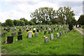
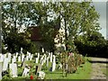

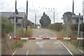
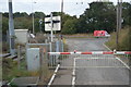
27 photos from this area
Area Information
Key information about the SS17 9HQ including its size, population, and administrative classification.
- Area Type
- Postcode
- Area Size
- 15.0 hectares
- Population
- 1547
- Population Density
- 890 people/km²
House Prices in SS17 9HQ
11
Properties
£357,710
Average Sold Price
£104,550
Lowest Price
£515,000
Highest Price
Showing 11 properties
| Address | Type | Beds | Baths | Last Sale Price | Last Sale Date | |
|---|---|---|---|---|---|---|
| Quorn, Moores Avenue, Fobbing, SS17 9HQ | Bungalow | - | - | £515,000 | Jun 2021 | |
| Southview, Moores Avenue, Fobbing, SS17 9HQ | Bungalow | 3 | 2 | £515,000 | Jun 2016 | |
| Magnolia, Moores Avenue, Fobbing, SS17 9HQ | Bungalow | 4 | - | £310,000 | Nov 2013 | |
| Queenville, Moores Avenue, Fobbing, SS17 9HQ | Bungalow | 3 | 2 | £344,000 | Sep 2006 | |
| Alba, Moores Avenue, Fobbing, SS17 9HQ | Detached | - | - | £104,550 | Dec 1997 | |
| COYNACH, MOORES AVENUE, Fobbing, SS17 9HQ | Detached | 3 | 2 | - | - | |
| The Willows, Moores Avenue, Fobbing, SS17 9HQ | Mobile Home | - | - | - | - | |
| Dukes Place, Moores Avenue, Fobbing, SS17 9HQ | Detached | - | - | - | - | |
| Kozy Kot, Moores Avenue, Fobbing, SS17 9HQ | Bungalow | - | - | - | - | |
| Homestead, Moores Avenue, Fobbing, SS17 9HQ | Detached | - | - | - | - |
Page 1 of 2
Energy Efficiency in SS17 9HQ
Amenities
Schools
| Rank | School | Type | Entry gender | Ages |
|---|
Explore more schools in this area
Go to Schools tabDemographics
Household Size
Family (3-5 people)
most common
Accommodation Type
Houses
most common
Tenure
90
majority
Ethnic Group
White
most common
Religion
N/A
most common
Household Composition
N/A
most common
Age
47
median
Adults (30-64 years)
most common
Household Deprivation
N/A
with no deprivation
NS-SEC
39
in Lower managerial occupations
Explore more demographic insights in this area
Go to Demographics tabPlanning
Planning Constraints
- Flood RiskPremium
- Ramsar Wetland SitesPremium
- Area of Outstanding Natural BeautyPremium
- Protected Nature ReservePremium
- Protected WoodlandPremium