Area Overview for SS17 9ET
Photos of SS17 9ET
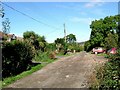

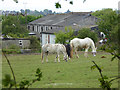
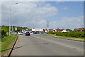

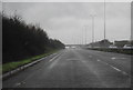
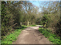


10 photos from this area
Area Information
Key information about the SS17 9ET including its size, population, and administrative classification.
- Area Type
- Postcode
- Area Size
- 22.1 hectares
- Population
- 1529
- Population Density
- 430 people/km²
House Prices in SS17 9ET
22
Properties
£227,500
Average Sold Price
£50,000
Lowest Price
£528,000
Highest Price
Showing 22 properties
| Address | Type | Beds | Baths | Last Sale Price | Last Sale Date | |
|---|---|---|---|---|---|---|
| Staplehurst, Southend Road, Corringham, SS17 9ET | Bungalow | - | - | £528,000 | Mar 2022 | |
| Jagles Rest, Southend Road, Corringham, SS17 9ET | Semi-detached | - | - | £305,000 | Jun 2016 | |
| Casa Mia, Southend Road, Corringham, SS17 9ET | Bungalow | 2 | 1 | £525,000 | Mar 2016 | |
| Chestnuts, Southend Road, Corringham, SS17 9ET | Bungalow | 4 | 3 | £134,000 | Nov 2001 | |
| Lawrene, Southend Road, Corringham, SS17 9ET | Detached | - | - | £98,000 | Mar 2001 | |
| Hazelwood Cottage, Southend Road, Corringham, SS17 9ET | Bungalow | 3 | 1 | £120,000 | May 2000 | |
| Joydor, Southend Road, Corringham, SS17 9ET | Semi-detached | - | - | £50,000 | Aug 1998 | |
| Ferndale, Southend Road, Corringham, SS17 9ET | Semi-detached | - | - | £60,000 | Jun 1998 | |
| Shirley, Southend Road, Corringham, SS17 9ET | Bungalow | 4 | 3 | - | - | |
| Lilac Cottage, Southend Road, Corringham, SS17 9ET | Detached | 3 | 1 | - | - |
Page 1 of 3
Energy Efficiency in SS17 9ET
Amenities
Schools
| Rank | School | Type | Entry gender | Ages |
|---|
Explore more schools in this area
Go to Schools tabDemographics
Household Size
Two person
most common
Accommodation Type
Houses
most common
Tenure
84
majority
Ethnic Group
White
most common
Religion
N/A
most common
Household Composition
N/A
most common
Age
47
median
Adults (30-64 years)
most common
Household Deprivation
N/A
with no deprivation
NS-SEC
27
in Lower managerial occupations
Explore more demographic insights in this area
Go to Demographics tabPlanning
Planning Constraints
- Flood RiskPremium
- Ramsar Wetland SitesPremium
- Area of Outstanding Natural BeautyPremium
- Protected Nature ReservePremium
- Protected WoodlandPremium