Area Overview for SS17 8DG
Photos of SS17 8DG
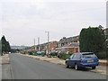
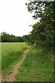


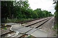

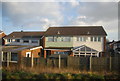
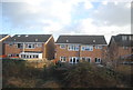
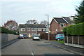

14 photos from this area
Area Information
Key information about the SS17 8DG including its size, population, and administrative classification.
- Area Type
- Postcode
- Area Size
- 7506 m²
- Population
- 1373
- Population Density
- 1530 people/km²
House Prices in SS17 8DG
22
Properties
£268,350
Average Sold Price
£79,000
Lowest Price
£450,000
Highest Price
Showing 22 properties
| Address | Type | Beds | Baths | Last Sale Price | Last Sale Date | |
|---|---|---|---|---|---|---|
| Westleton, Struan Avenue, Stanford Le Hope, SS17 8DG | Semi-detached | 4 | 3 | £450,000 | Jun 2022 | |
| Trevinda, Struan Avenue, Stanford Le Hope, SS17 8DG | Semi-detached | 3 | - | £335,000 | Apr 2021 | |
| Alouette, Struan Avenue, Stanford Le Hope, SS17 8DG | Semi-detached | 4 | 3 | £426,500 | May 2020 | |
| Pandora, Struan Avenue, Stanford Le Hope, SS17 8DG | Semi-detached | 3 | 1 | £301,000 | Jan 2019 | |
| Vectis, Struan Avenue, Stanford Le Hope, SS17 8DG | Semi-detached | 3 | 1 | £299,995 | Nov 2018 | |
| Waycliff, Struan Avenue, Stanford Le Hope, SS17 8DG | Semi-detached | 3 | 1 | £235,000 | Dec 2014 | |
| Honsel, Struan Avenue, Stanford Le Hope, SS17 8DG | house | - | - | £245,000 | Mar 2007 | |
| Cynala, Struan Avenue, Stanford Le Hope, SS17 8DG | Semi-detached | - | - | £200,000 | Mar 2004 | |
| Waikato, Struan Avenue, Stanford Le Hope, SS17 8DG | house | - | - | £112,000 | Aug 2000 | |
| Naticina, Struan Avenue, Stanford Le Hope, SS17 8DG | Semi-detached | 4 | 2 | £79,000 | Jul 1996 |
Page 1 of 3
Energy Efficiency in SS17 8DG
Amenities
Schools
| Rank | School | Type | Entry gender | Ages |
|---|
Explore more schools in this area
Go to Schools tabDemographics
Household Size
Family (3-5 people)
most common
Accommodation Type
Houses
most common
Tenure
93
majority
Ethnic Group
White
most common
Religion
N/A
most common
Household Composition
N/A
most common
Age
47
median
Adults (30-64 years)
most common
Household Deprivation
N/A
with no deprivation
NS-SEC
30
in Lower managerial occupations
Explore more demographic insights in this area
Go to Demographics tabPlanning
Planning Constraints
- Flood RiskPremium
- Ramsar Wetland SitesPremium
- Area of Outstanding Natural BeautyPremium
- Protected Nature ReservePremium
- Protected WoodlandPremium