Area Overview for SS17 7JU
Photos of SS17 7JU
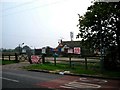
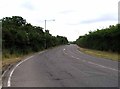
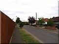
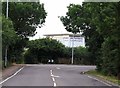
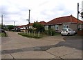
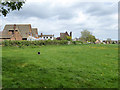
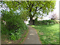
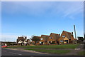
13 photos from this area
Area Information
Key information about the SS17 7JU including its size, population, and administrative classification.
- Area Type
- Postcode
- Area Size
- 1.2 hectares
- Population
- 1570
- Population Density
- 5277 people/km²
House Prices in SS17 7JU
46
Properties
£193,000
Average Sold Price
£34,000
Lowest Price
£280,000
Highest Price
Showing 46 properties
| Address | Type | Beds | Baths | Last Sale Price | Last Sale Date | |
|---|---|---|---|---|---|---|
| 249 Crawley Close, Corringham, SS17 7JU | Flat | - | - | £160,000 | May 2024 | |
| 231 Crawley Close, Corringham, SS17 7JU | Flat | 2 | 1 | £220,000 | Mar 2024 | |
| 255 Crawley Close, Corringham, SS17 7JU | Terraced | 3 | 1 | £280,000 | Mar 2024 | |
| 234 Crawley Close, Corringham, SS17 7JU | Flat | - | - | £220,000 | Nov 2021 | |
| 270 Crawley Close, Corringham, SS17 7JU | house | - | - | £250,000 | Aug 2020 | |
| 236 Crawley Close, Corringham, SS17 7JU | house | - | - | £250,000 | Jul 2019 | |
| 258 Crawley Close, Corringham, SS17 7JU | Terraced | 3 | 1 | £230,000 | May 2019 | |
| 250 Crawley Close, Corringham, SS17 7JU | Maisonette | 2 | 1 | £205,000 | Oct 2018 | |
| 246 Crawley Close, Corringham, SS17 7JU | Flat | - | - | £180,000 | Jun 2018 | |
| 257 Crawley Close, Corringham, SS17 7JU | Terraced | 3 | 2 | £247,000 | May 2018 |
Page 1 of 5
Energy Efficiency in SS17 7JU
Amenities
Schools
| Rank | School | Type | Entry gender | Ages |
|---|
Explore more schools in this area
Go to Schools tabDemographics
Household Size
Family (3-5 people)
most common
Accommodation Type
Houses
most common
Tenure
58
majority
Ethnic Group
White
most common
Religion
N/A
most common
Household Composition
N/A
most common
Age
47
median
Adults (30-64 years)
most common
Household Deprivation
N/A
with no deprivation
NS-SEC
23
in Lower managerial occupations
Explore more demographic insights in this area
Go to Demographics tabPlanning
Planning Constraints
- Flood RiskPremium
- Ramsar Wetland SitesPremium
- Area of Outstanding Natural BeautyPremium
- Protected Nature ReservePremium
- Protected WoodlandPremium