Area Overview for SS17 7AT
Photos of SS17 7AT
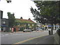
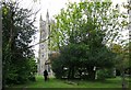
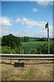
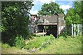

47 photos from this area
Area Information
Key information about the SS17 7AT including its size, population, and administrative classification.
- Area Type
- Postcode
- Area Size
- 1.2 hectares
- Population
- 1543
- Population Density
- 7265 people/km²
House Prices in SS17 7AT
32
Properties
£184,794
Average Sold Price
£60,000
Lowest Price
£323,000
Highest Price
Showing 32 properties
| Address | Type | Beds | Baths | Last Sale Price | Last Sale Date | |
|---|---|---|---|---|---|---|
| 22 Plaistow Close, Stanford Le Hope, SS17 7AT | Flat | 1 | 1 | £210,000 | Feb 2025 | |
| 27 Plaistow Close, Stanford Le Hope, SS17 7AT | Semi-detached | 3 | - | £323,000 | Apr 2022 | |
| 6 Plaistow Close, Stanford Le Hope, SS17 7AT | house | - | - | £290,000 | Apr 2022 | |
| 20 Plaistow Close, Stanford Le Hope, SS17 7AT | Terraced | 4 | 1 | £303,000 | Aug 2020 | |
| 2 Plaistow Close, Stanford Le Hope, SS17 7AT | Terraced | 3 | 1 | £268,000 | Apr 2020 | |
| 19 Plaistow Close, Stanford Le Hope, SS17 7AT | house | 3 | 1 | £240,000 | Aug 2019 | |
| 21 Plaistow Close, Stanford Le Hope, SS17 7AT | house | 3 | - | £260,000 | Sep 2018 | |
| 10 Plaistow Close, Stanford Le Hope, SS17 7AT | house | - | - | £210,000 | Mar 2015 | |
| 11 Plaistow Close, Stanford Le Hope, SS17 7AT | house | 2 | - | £135,000 | Dec 2010 | |
| 5 Plaistow Close, Stanford Le Hope, SS17 7AT | Terraced | 2 | 1 | £122,500 | Mar 2009 |
Page 1 of 4
Energy Efficiency in SS17 7AT
Amenities
Schools
| Rank | School | Type | Entry gender | Ages |
|---|
Explore more schools in this area
Go to Schools tabDemographics
Household Size
Family (3-5 people)
most common
Accommodation Type
Houses
most common
Tenure
50
majority
Ethnic Group
White
most common
Religion
N/A
most common
Household Composition
N/A
most common
Age
47
median
Adults (30-64 years)
most common
Household Deprivation
N/A
with no deprivation
NS-SEC
21
in Lower managerial occupations
Explore more demographic insights in this area
Go to Demographics tabPlanning
Planning Constraints
- Flood RiskPremium
- Ramsar Wetland SitesPremium
- Area of Outstanding Natural BeautyPremium
- Protected Nature ReservePremium
- Protected WoodlandPremium