Area Overview for SS17 0RF
Photos of SS17 0RF
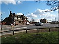

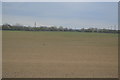
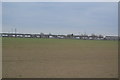

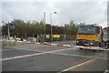


38 photos from this area
Area Information
Key information about the SS17 0RF including its size, population, and administrative classification.
- Area Type
- Postcode
- Area Size
- 2.5 hectares
- Population
- 1787
- Population Density
- 244 people/km²
House Prices in SS17 0RF
27
Properties
£276,694
Average Sold Price
£71,000
Lowest Price
£575,000
Highest Price
Showing 27 properties
| Address | Type | Beds | Baths | Last Sale Price | Last Sale Date | |
|---|---|---|---|---|---|---|
| Tumbledown, Muckingford Road, Linford, SS17 0RF | Retail | 4 | 1 | £575,000 | Dec 2022 | |
| Fondril, Muckingford Road, Linford, SS17 0RF | house | - | - | £470,000 | Mar 2022 | |
| Farthings, Muckingford Road, Linford, SS17 0RF | Semi-detached | 2 | 2 | £378,500 | Sep 2021 | |
| Tensing, Muckingford Road, Linford, SS17 0RF | Bungalow | - | - | £499,000 | Jun 2021 | |
| Wekiva, Muckingford Road, Linford, SS17 0RF | Bungalow | 3 | 1 | £375,000 | Mar 2018 | |
| Lana, Muckingford Road, Linford, SS17 0RF | Semi-detached | 2 | 1 | £277,000 | Apr 2016 | |
| Erin, Muckingford Road, Linford, SS17 0RF | Bungalow | - | - | £347,000 | Feb 2016 | |
| Sunray, Muckingford Road, Linford, SS17 0RF | Bungalow | - | - | £220,000 | Jul 2014 | |
| Brixham, Muckingford Road, Linford, SS17 0RF | Bungalow | - | - | £235,000 | Nov 2010 | |
| Adelaide, Muckingford Road, Linford, SS17 0RF | Bungalow | 4 | 1 | £207,000 | Aug 2010 |
Page 1 of 3
Energy Efficiency in SS17 0RF
Amenities
Schools
| Rank | School | Type | Entry gender | Ages |
|---|
Explore more schools in this area
Go to Schools tabDemographics
Household Size
Family (3-5 people)
most common
Accommodation Type
Houses
most common
Tenure
83
majority
Ethnic Group
White
most common
Religion
N/A
most common
Household Composition
N/A
most common
Age
47
median
Adults (30-64 years)
most common
Household Deprivation
N/A
with no deprivation
NS-SEC
28
in Lower managerial occupations
Explore more demographic insights in this area
Go to Demographics tabPlanning
Planning Constraints
- Flood RiskPremium
- Ramsar Wetland SitesPremium
- Area of Outstanding Natural BeautyPremium
- Protected Nature ReservePremium
- Protected WoodlandPremium