Area Overview for SS17 0EN
Photos of SS17 0EN
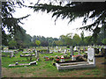
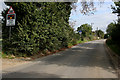
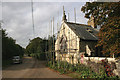
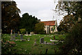


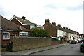

48 photos from this area
Area Information
Key information about the SS17 0EN including its size, population, and administrative classification.
- Area Type
- Postcode
- Area Size
- 7796 m²
- Population
- 2852
- Population Density
- 610 people/km²
House Prices in SS17 0EN
27
Properties
£226,235
Average Sold Price
£40,000
Lowest Price
£355,000
Highest Price
Showing 27 properties
| Address | Type | Beds | Baths | Last Sale Price | Last Sale Date | |
|---|---|---|---|---|---|---|
| 37 St Margarets Avenue, Stanford Le Hope, SS17 0EN | Terraced | 3 | 1 | £350,000 | Mar 2023 | |
| 21 St Margarets Avenue, Stanford Le Hope, SS17 0EN | house | - | - | £355,000 | Jul 2022 | |
| 61 St Margarets Avenue, Stanford Le Hope, SS17 0EN | house | - | - | £350,000 | Dec 2021 | |
| 33 St Margarets Avenue, Stanford Le Hope, SS17 0EN | house | - | - | £277,000 | Aug 2021 | |
| 27 St Margarets Avenue, Stanford Le Hope, SS17 0EN | house | - | - | £282,000 | Aug 2021 | |
| 67 St Margarets Avenue, Stanford Le Hope, SS17 0EN | Semi-detached | 4 | 2 | £310,000 | Feb 2021 | |
| 31 St Margarets Avenue, Stanford Le Hope, SS17 0EN | Terraced | 3 | 1 | £251,500 | Jul 2019 | |
| 23 St Margarets Avenue, Stanford Le Hope, SS17 0EN | Terraced | 3 | 1 | £276,000 | Sep 2017 | |
| 29 St Margarets Avenue, Stanford Le Hope, SS17 0EN | Terraced | 3 | 1 | £240,000 | Nov 2016 | |
| 25 St Margarets Avenue, Stanford Le Hope, SS17 0EN | Terraced | - | - | £233,000 | Jun 2016 |
Page 1 of 3
Energy Efficiency in SS17 0EN
Amenities
Schools
| Rank | School | Type | Entry gender | Ages |
|---|
Explore more schools in this area
Go to Schools tabDemographics
Household Size
Family (3-5 people)
most common
Accommodation Type
Houses
most common
Tenure
68
majority
Ethnic Group
White
most common
Religion
N/A
most common
Household Composition
N/A
most common
Age
47
median
Adults (30-64 years)
most common
Household Deprivation
N/A
with no deprivation
NS-SEC
33
in Lower managerial occupations
Explore more demographic insights in this area
Go to Demographics tabPlanning
Planning Constraints
- Flood RiskPremium
- Ramsar Wetland SitesPremium
- Area of Outstanding Natural BeautyPremium
- Protected Nature ReservePremium
- Protected WoodlandPremium