Area Overview for SS16 5UP
Photos of SS16 5UP
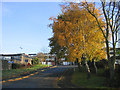
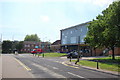
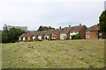
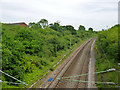
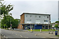
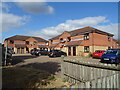
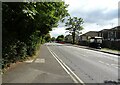
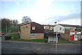
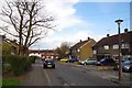
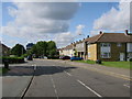
17 photos from this area
Area Information
Key information about the SS16 5UP including its size, population, and administrative classification.
- Area Type
- Postcode
- Area Size
- 1.2 hectares
- Population
- 1666
- Population Density
- 4092 people/km²
House Prices in SS16 5UP
21
Properties
£287,988
Average Sold Price
£75,000
Lowest Price
£395,890
Highest Price
Showing 21 properties
| Address | Type | Beds | Baths | Last Sale Price | Last Sale Date | |
|---|---|---|---|---|---|---|
| 27 Kingswood Road, Basildon, SS16 5UP | Bungalow | 3 | 2 | £325,000 | Nov 2025 | |
| Roger Hurst Rods & Tackle, 13 Kingswood Road, Basildon, SS16 5UP | Terraced | 3 | 2 | £395,890 | Dec 2024 | |
| 1 Kingswood Road, Basildon, SS16 5UP | Terraced | 3 | - | £345,000 | Nov 2023 | |
| 7 Kingswood Road, Basildon, SS16 5UP | Terraced | 3 | 2 | £355,000 | Mar 2023 | |
| 15 Kingswood Road, Basildon, SS16 5UP | Bungalow | - | - | £370,000 | Aug 2022 | |
| 21 Kingswood Road, Basildon, SS16 5UP | Bungalow | - | - | £356,000 | Sep 2021 | |
| 3 Kingswood Road, Basildon, SS16 5UP | Semi-detached | 3 | 1 | £290,000 | Sep 2020 | |
| 9 Kingswood Road, Basildon, SS16 5UP | Bungalow | 3 | - | £320,000 | Aug 2020 | |
| 11 Kingswood Road, Basildon, SS16 5UP | Terraced | 3 | 1 | £270,000 | Feb 2019 | |
| 33 Kingswood Road, Basildon, SS16 5UP | Terraced | 3 | 2 | £305,000 | Dec 2018 |
Page 1 of 3
Energy Efficiency in SS16 5UP
Amenities
Schools
| Rank | School | Type | Entry gender | Ages |
|---|
Explore more schools in this area
Go to Schools tabDemographics
Household Size
Family (3-5 people)
most common
Accommodation Type
Houses
most common
Tenure
58
majority
Ethnic Group
White
most common
Religion
N/A
most common
Household Composition
N/A
most common
Age
47
median
Adults (30-64 years)
most common
Household Deprivation
N/A
with no deprivation
NS-SEC
29
in Lower managerial occupations
Explore more demographic insights in this area
Go to Demographics tabPlanning
Planning Constraints
- Flood RiskPremium
- Ramsar Wetland SitesPremium
- Area of Outstanding Natural BeautyPremium
- Protected Nature ReservePremium
- Protected WoodlandPremium