Area Overview for SS16 4QU
Photos of SS16 4QU
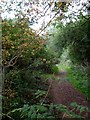
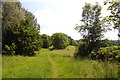
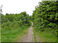
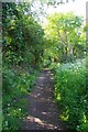
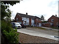
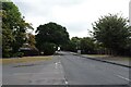
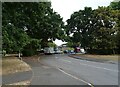
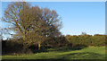

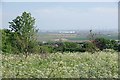

11 photos from this area
Area Information
Key information about the SS16 4QU including its size, population, and administrative classification.
- Area Type
- Postcode
- Area Size
- 7.6 hectares
- Population
- 2137
- Population Density
- 802 people/km²
House Prices in SS16 4QU
25
Properties
£359,463
Average Sold Price
£92,000
Lowest Price
£600,000
Highest Price
Showing 25 properties
| Address | Type | Beds | Baths | Last Sale Price | Last Sale Date | |
|---|---|---|---|---|---|---|
| 17 Hillcrest View, Vange, Basildon, SS16 4QU | Detached | 5 | 2 | £425,000 | Jul 2025 | |
| 10 Hillcrest View, Vange, Basildon, SS16 4QU | Detached | 4 | 3 | £505,000 | May 2025 | |
| 16 Hillcrest View, Vange, Basildon, SS16 4QU | Detached | 5 | 3 | £600,000 | Mar 2023 | |
| 25 Hillcrest View, Vange, Basildon, SS16 4QU | Detached | 4 | - | £582,500 | Apr 2021 | |
| 30 Hillcrest View, Vange, Basildon, SS16 4QU | Detached | 4 | 3 | £462,000 | Jun 2020 | |
| 28 Hillcrest View, Vange, Basildon, SS16 4QU | Detached | 4 | 1 | £450,000 | Sep 2019 | |
| 36 Hillcrest View, Vange, Basildon, SS16 4QU | Detached | 4 | 1 | £550,000 | Feb 2018 | |
| 14 Hillcrest View, Vange, Basildon, SS16 4QU | Detached | 4 | 2 | £414,000 | Feb 2018 | |
| 32 Hillcrest View, Vange, Basildon, SS16 4QU | Detached | 4 | 2 | £490,000 | Nov 2016 | |
| 22 Hillcrest View, Vange, Basildon, SS16 4QU | Detached | 4 | 2 | £380,000 | Apr 2016 |
Page 1 of 3
Energy Efficiency in SS16 4QU
Amenities
Schools
| Rank | School | Type | Entry gender | Ages |
|---|
Explore more schools in this area
Go to Schools tabDemographics
Household Size
Family (3-5 people)
most common
Accommodation Type
Houses
most common
Tenure
52
majority
Ethnic Group
White
most common
Religion
N/A
most common
Household Composition
N/A
most common
Age
47
median
Adults (30-64 years)
most common
Household Deprivation
N/A
with no deprivation
NS-SEC
25
in Lower managerial occupations
Explore more demographic insights in this area
Go to Demographics tabPlanning
Planning Constraints
- Flood RiskPremium
- Ramsar Wetland SitesPremium
- Area of Outstanding Natural BeautyPremium
- Protected Nature ReservePremium
- Protected WoodlandPremium