Area Overview for SS15 6QF
Photos of SS15 6QF
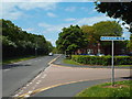
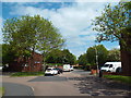
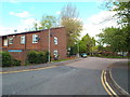
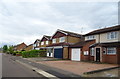
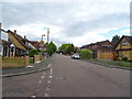
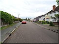
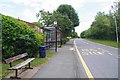
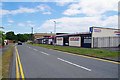
23 photos from this area
Area Information
Key information about the SS15 6QF including its size, population, and administrative classification.
- Area Type
- Postcode
- Area Size
- 1.1 hectares
- Population
- 1515
- Population Density
- 5210 people/km²
House Prices in SS15 6QF
24
Properties
£195,666
Average Sold Price
£27,000
Lowest Price
£340,000
Highest Price
Showing 24 properties
| Address | Type | Beds | Baths | Last Sale Price | Last Sale Date | |
|---|---|---|---|---|---|---|
| 12 Panfields, Laindon, Basildon, SS15 6QF | Terraced | 3 | 1 | £333,000 | Jan 2023 | |
| 24 Panfields, Laindon, Basildon, SS15 6QF | Terraced | 3 | - | £340,000 | Sep 2022 | |
| 17 Panfields, Laindon, Basildon, SS15 6QF | Terraced | 3 | 1 | £270,000 | Apr 2021 | |
| 14 Panfields, Laindon, Basildon, SS15 6QF | Terraced | 3 | 1 | £250,000 | Jan 2018 | |
| 20 Panfields, Laindon, Basildon, SS15 6QF | Flat | - | - | £183,000 | Jan 2017 | |
| 23 Panfields, Laindon, Basildon, SS15 6QF | Terraced | 3 | - | £155,000 | Sep 2013 | |
| 11 Panfields, Laindon, Basildon, SS15 6QF | Terraced | - | - | £111,000 | Feb 2006 | |
| 21 Panfields, Laindon, Basildon, SS15 6QF | Semi-detached | - | - | £91,995 | Jul 2003 | |
| 7 Panfields, Laindon, Basildon, SS15 6QF | Flat | - | - | £27,000 | Sep 1996 | |
| 25 Panfields, Laindon, Basildon, SS15 6QF | Terraced | 4 | 2 | - | - |
Page 1 of 3
Energy Efficiency in SS15 6QF
Amenities
Schools
| Rank | School | Type | Entry gender | Ages |
|---|
Explore more schools in this area
Go to Schools tabDemographics
Household Size
One person
most common
Accommodation Type
Houses
most common
Tenure
53
majority
Ethnic Group
White
most common
Religion
N/A
most common
Household Composition
N/A
most common
Age
47
median
Adults (30-64 years)
most common
Household Deprivation
N/A
with no deprivation
NS-SEC
28
in Lower managerial occupations
Explore more demographic insights in this area
Go to Demographics tabPlanning
Planning Constraints
- Flood RiskPremium
- Ramsar Wetland SitesPremium
- Area of Outstanding Natural BeautyPremium
- Protected Nature ReservePremium
- Protected WoodlandPremium