Area Overview for SS15 6BE
Photos of SS15 6BE
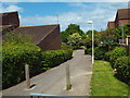
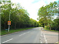
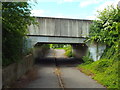
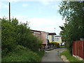
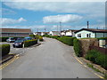
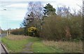
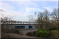
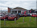
22 photos from this area
Area Information
Key information about the SS15 6BE including its size, population, and administrative classification.
- Area Type
- Postcode
- Area Size
- 2.1 hectares
- Population
- 1413
- Population Density
- 531 people/km²
House Prices in SS15 6BE
55
Properties
£232,210
Average Sold Price
£52,000
Lowest Price
£440,000
Highest Price
Showing 55 properties
| Address | Type | Beds | Baths | Last Sale Price | Last Sale Date | |
|---|---|---|---|---|---|---|
| 28 Brooklands Park, Basildon, SS15 6BE | Terraced | 3 | 1 | £325,000 | Oct 2025 | |
| 2 Brooklands Park, Basildon, SS15 6BE | Detached | 3 | 1 | £382,500 | Aug 2025 | |
| 53 Brooklands Park, Basildon, SS15 6BE | Terraced | 3 | 2 | £400,000 | Jul 2024 | |
| 54 Brooklands Park, Basildon, SS15 6BE | Terraced | 2 | 1 | £338,000 | Nov 2022 | |
| 23 Brooklands Park, Basildon, SS15 6BE | house | - | - | £312,000 | May 2022 | |
| 30 Brooklands Park, Basildon, SS15 6BE | Retail | 2 | 1 | £305,000 | Apr 2022 | |
| 56 Brooklands Park, Basildon, SS15 6BE | house | - | - | £245,000 | Mar 2022 | |
| 48 Brooklands Park, Basildon, SS15 6BE | Terraced | 1 | 1 | £337,000 | Jan 2022 | |
| 44 Brooklands Park, Basildon, SS15 6BE | house | 2 | - | £280,000 | Sep 2021 | |
| 36 Brooklands Park, Basildon, SS15 6BE | house | - | - | £291,000 | Mar 2021 |
Page 1 of 6
Energy Efficiency in SS15 6BE
Amenities
Schools
| Rank | School | Type | Entry gender | Ages |
|---|
Explore more schools in this area
Go to Schools tabDemographics
Household Size
Two person
most common
Accommodation Type
Houses
most common
Tenure
69
majority
Ethnic Group
White
most common
Religion
N/A
most common
Household Composition
N/A
most common
Age
47
median
Adults (30-64 years)
most common
Household Deprivation
N/A
with no deprivation
NS-SEC
26
in Lower managerial occupations
Explore more demographic insights in this area
Go to Demographics tabPlanning
Planning Constraints
- Flood RiskPremium
- Ramsar Wetland SitesPremium
- Area of Outstanding Natural BeautyPremium
- Protected Nature ReservePremium
- Protected WoodlandPremium