Area Overview for SS15 5UT
Photos of SS15 5UT
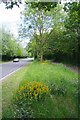
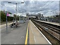
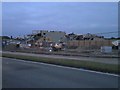
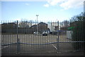
22 photos from this area
Area Information
Key information about the SS15 5UT including its size, population, and administrative classification.
- Area Type
- Postcode
- Area Size
- 1.0 hectares
- Population
- 1948
- Population Density
- 4429 people/km²
House Prices in SS15 5UT
10
Properties
£310,562
Average Sold Price
£88,500
Lowest Price
£480,000
Highest Price
Showing 10 properties
| Address | Type | Beds | Baths | Last Sale Price | Last Sale Date | |
|---|---|---|---|---|---|---|
| 10 Albert Drive, Laindon, SS15 5UT | Bungalow | 3 | 1 | £480,000 | Jun 2024 | |
| 9 Albert Drive, Laindon, SS15 5UT | Detached | 4 | 2 | £470,000 | Jan 2023 | |
| 15 Albert Drive, Laindon, SS15 5UT | Detached | 4 | 3 | £360,000 | Mar 2020 | |
| 4 Albert Drive, Laindon, SS15 5UT | house | 1 | - | £395,000 | Feb 2016 | |
| 7 Albert Drive, Laindon, SS15 5UT | Bungalow | 4 | 2 | £295,000 | Jun 2012 | |
| 6 Albert Drive, Laindon, SS15 5UT | Detached | 2 | 1 | £245,995 | Apr 2004 | |
| 11 Albert Drive, Laindon, SS15 5UT | Detached | 4 | 2 | £150,000 | Jul 2001 | |
| 3 Albert Drive, Laindon, SS15 5UT | Bungalow | 3 | 1 | £88,500 | Sep 1998 | |
| 12 Albert Drive, Laindon, SS15 5UT | Detached | 4 | 3 | - | - | |
| 8 Albert Drive, Laindon, SS15 5UT | Detached | - | - | - | - |
Energy Efficiency in SS15 5UT
Amenities
Schools
| Rank | School | Type | Entry gender | Ages |
|---|
Explore more schools in this area
Go to Schools tabDemographics
Household Size
Family (3-5 people)
most common
Accommodation Type
Houses
most common
Tenure
49
majority
Ethnic Group
White
most common
Religion
N/A
most common
Household Composition
N/A
most common
Age
47
median
Adults (30-64 years)
most common
Household Deprivation
N/A
with no deprivation
NS-SEC
25
in Lower managerial occupations
Explore more demographic insights in this area
Go to Demographics tabPlanning
Planning Constraints
- Flood RiskPremium
- Ramsar Wetland SitesPremium
- Area of Outstanding Natural BeautyPremium
- Protected Nature ReservePremium
- Protected WoodlandPremium