Area Overview for SS15 5LP
Photos of SS15 5LP


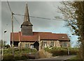
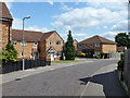
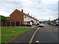
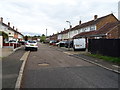


11 photos from this area
Area Information
Key information about the SS15 5LP including its size, population, and administrative classification.
- Area Type
- Postcode
- Area Size
- 7876 m²
- Population
- 1948
- Population Density
- 4429 people/km²
House Prices in SS15 5LP
34
Properties
£187,975
Average Sold Price
£44,000
Lowest Price
£317,000
Highest Price
Showing 34 properties
| Address | Type | Beds | Baths | Last Sale Price | Last Sale Date | |
|---|---|---|---|---|---|---|
| 83 Woolmer Green, Laindon, Basildon, SS15 5LP | Terraced | 3 | 1 | £317,000 | Aug 2024 | |
| 101 Woolmer Green, Laindon, Basildon, SS15 5LP | Terraced | 3 | 1 | £305,000 | May 2024 | |
| 123 Woolmer Green, Laindon, Basildon, SS15 5LP | Retail | 3 | - | £301,000 | May 2022 | |
| 137 Woolmer Green, Laindon, Basildon, SS15 5LP | Detached | 3 | 1 | £305,000 | Apr 2022 | |
| 139 Woolmer Green, Laindon, Basildon, SS15 5LP | house | 3 | - | £305,000 | Jan 2022 | |
| 89 Woolmer Green, Laindon, Basildon, SS15 5LP | Terraced | 3 | 1 | £291,000 | Jun 2021 | |
| 93 Woolmer Green, Laindon, Basildon, SS15 5LP | house | - | - | £250,000 | Apr 2021 | |
| 121 Woolmer Green, Laindon, Basildon, SS15 5LP | house | - | - | £255,000 | Feb 2021 | |
| 129 Woolmer Green, Laindon, Basildon, SS15 5LP | Terraced | 3 | 1 | £255,000 | Nov 2020 | |
| 115 Woolmer Green, Laindon, Basildon, SS15 5LP | Terraced | 2 | 1 | £218,000 | Oct 2019 |
Page 1 of 4
Energy Efficiency in SS15 5LP
Amenities
Schools
| Rank | School | Type | Entry gender | Ages |
|---|
Explore more schools in this area
Go to Schools tabDemographics
Household Size
Family (3-5 people)
most common
Accommodation Type
Houses
most common
Tenure
49
majority
Ethnic Group
White
most common
Religion
N/A
most common
Household Composition
N/A
most common
Age
47
median
Adults (30-64 years)
most common
Household Deprivation
N/A
with no deprivation
NS-SEC
25
in Lower managerial occupations
Explore more demographic insights in this area
Go to Demographics tabPlanning
Planning Constraints
- Flood RiskPremium
- Ramsar Wetland SitesPremium
- Area of Outstanding Natural BeautyPremium
- Protected Nature ReservePremium
- Protected WoodlandPremium